Friday, June 28, 2013

Property on Greers Ferry Lake, AR.

                                  Friday 6/21/2013

After a day of just hanging out at our resort in Mountain View, we schedule an appointment to see a property on Greers Ferry Lake. We took the same route that we had come on to Mountain View, but just going the opposite direction. Our drive took an hour to get to the lake.

We stopped at Cove Creek Park to see the lake up close.

This is a very nice US Army Corps of Engineers campground, with paved sites.

We drove to the boat launch, and walked out on the dock. This area was a little flooded out.

We were going to see property on top of the mountain in this picture.

Once we got to the top, I saw some donkeys on what was the property we came to looked at. ( I didn't know this was the property at the time). 

When I got out to take the donkey's pictures, they started to call out to say Hi. Boy are they loud!

We continued down a hill to the owners home who owns the properties.

We spent some time inside their home, while Paul went over a booklet of information of the lots that were for sale. Then he took us out to his back yard to see his views. Every room in the back of his home has amazing views of the lake.

Here are Paul and Dot's views from their deck, looking southeast

Looking east from his deck.

And then looking northeast from the deck.


Then we walked to the edge of his property, and looked north.

Then northeast.

Then east.


Paul said we needed a picture of us with the lake in the background. His back yard sits on a bluff, and drops down the a height of a 60 floor building.

Paul then took us in his truck and drove us around his 168 acre property and showed us different lots. This lot was one that we were interested in. It is a long thin lot that has 4 1/2 acres. It also has a bluff area, which I would not like because I have small Nana kids, but it had a better view that the one I had come to see.

The lot has a gentle to moderate slope from the road. You would not see the house from the road. This lot cost $135,000.

After seeing the lots, Paul showed us his garden.

I walked around to see Dusty his palomino also.

As we left, I took another picture of the lot that I liked. It is 5 acres, and is $140,000. We would put the house down the hill where there is a far away view of the lake. I forgot to take a picture when Paul took us on the land in his truck. I couldn't walk back down to the site, because there is a fence and donkeys on the lot. There was another lot that had a 4 bedroom house on it. It is across the street from the lake, but had a nice view. The house sat on 4 1/2 acres and the asking price was $385,000. Joe said he would like that house and lot best for the price and not having to build, put in a drive, septic tank, and the headaches of building. Paul And Dot were wonderful people and would make great neighbors.

As we headed home we drove north on Diamond Ridge around the lake in the other direction.

Greers Ferry Lake sits at the foothills of the Ozarks in north central Arkansas

The lake was formed by the Greers Ferry Dam in 1964, and is a 40,000 acres lake.

It's a real pretty lake, but Joe and I think the summers are too hot, and think we need to find something further north. It has been in the high 90's the entire time we have been in Arkansas for June and part of May.

We went back to Mountain View on another route for different views.
When we got home, we drove a mile down the road from our resort and went to Jo Jo's for catfish.

It was highly recommended by several people, and the parking lot was full, with people waiting in line to get in to eat. It sits along the White River. We just order catfish to go, and skipped the "all you can eat hush puppies". Neither one of us needed the carbs/calories! The catfish was really good. 

Thursday, June 27, 2013

Holiday Mountain Resort, Mountain View, Arkansas


                                           Wednesday, June 19, 2013


I have got behind again, because we spent a week in a campground without any internet or phone service at our campsite. I will try to catch up this week while we spend a week in Omaha, Arkansas, which is just about 10 miles from the Missouri border and 20 miles from Branson, MO.
We left Little Rock, AR and headed northeast on I-67/167, and then turned north on Hwy 5.

After leaving I-67/167, it was a two lane Hwy. all the way. I enjoy these drives because they are much more scenic, but Joe dislikes them.

At first we had a nice wide shoulder, even though it was a constant curve after curve. Most of the curves were posted at 45 mph, some were 35 mph so it took a long time to cover the distance.

This is a view of Greers Ferry Lake as we came down a mountain side. Latter on in the week, we drove back to see a property for sale there, that I blog about later.

More of those pink blooming bushes; I have since found out from two people that they are called Mimosa, which is consider as an invasive weed because it spreads so much. No wonder I have been seeing them everywhere.

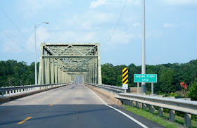
We crossed over the dam on Greers Ferry Lake.

A glimpse of Greers Ferry Lake to the west.


A glimpse of the Little Red River as it leaves Greers Ferry Lake. Sorry for the glare on the windows.

After leaving Greers Ferry Lake and Herber Springs, the road went from wide shoulders to no shoulders. This makes the drive for Joe a little more stressful. With a wide bus like ours it doesn't leave much room for error, and if we needed to pull over there wouldn't be enough room to fit.

Mallery sees some cows along the way and tells them they are in her territory.

Then we came to this very curvy and steep area, where the county is in the process to remedy it. Unfortunately it is not ready for our passage through the area.

This part of the construction was very, very stressful for Joe. Not only was there no shoulder, but the road dropped off quite a bit. When you are a wide RV, there is no room for error.  Just as we crested the  top of this road, Joe met a semi, which just made matters worse for him.

There were two routes to our next destination, and Joe was wishing he had gone on the other route, even though it was longer. But who knows what that route would have been like!

Mountain View was our next destination. It has a population of 2,748.

View as we headed into Mountain View. True to its name.

Our resort, was 6 miles north of Moutain View, and down between two mountains.

At the bottom of the mountain we saw this sign and turned left onto the road. If you are looking to purchase a RV resort, this park is going up for auction on July 25 and selling regardless of price. We came to this resort because it is a Coast To Coast park,which cost us $10 a day. While we were on our way to this park, Coast To Coast called us, to tell us that this park was going up for auction, and they did not know if they would honor the price or what condition it would be in.

The road leading you to the park is only about 1and 1/2 lanes wide. We just hoped we wouldn't meet another RV on the way in. This road is at least 1/2 of a mile to the resort.

We arrive to Holiday Mountain Resort, just before we get to the swinging bridge ahead. 

This is the office/store at Holiday Mountain Resort.

On the other side of the same building is the entrance to the club house where you can get a pretty decent internet signal. Joe and I used it a couple of times, but, I have a bad back, and my back hurt a lot while trying to sit in their chair for for a short time. I gave it up and decide to just wait until our next resort. ( So now I am behind once again).

The resort has 15 cabins up on the hill across from the office. One of those cabins is a huge cabin for a large family get together.

We had to drive the Nest down a steep hill, and cross a cement bridge that had large cracks in the cement and the bridge was bowed down in the middle, making it nerve racking as Joe crossed over the creek. The road going down to the bridge had been patched. You could tell that a section of the road had been washed out by a flood.

We found a spot in the park that we could get satellite service for our TV. There are only a couple of places in the park, that you can get it. If you get a spot without a satellite signal, you can pay $2.50/day for  their cable.

Our Nest was parked right across from the laundry/shower/pool area.You can see from this picture why we had no phone or internet service, with the way we sat at the bottom of that mountain.

We got our binoculars out, because we could barely see what looked like a house on the top of the ridge.

Sure enough, there was a house sitting on the edge of the bluff.

The pool is adequate for those who like to swim in a chlorinated pool. I have enough chemicals in my environment, so I avoid pools.

The bathhouse/laundry has a new roof on it, but Joe said the inside needs to be updated.

After setting up we walked the park to finish our review of it.

Sylamore Creek runs through the park and joins the White River a few miles down stream.

We walked up the hill from the creek and back out to the front of the park, then turned toward the swinging bridge on Swinging Bridge Road, that was built in 1943 and rebuilt in 1985 after a flood damaged it.

There is a sign before the bridge giving weight restrictions. Our motorhome is too heavy to cross. 
The dimensions of the bridge are
Total length: 200.0 ft.
Deck width: 11.1 ft. and, vertical clearance above deck: 13.9 ft. 


I didn't like walking across the bridge as it had large gaps between the wood planks. As you walked across the bridge, we could feel it swing. I found this information about the bridge below:


Inspection (as of 01/2012)
Deck condition rating: Poor (4 out of 9)
Superstructure condition rating: Fair (5 out of 9)
Substructure condition rating: Good (7 out of 9)
Appraisal: Structurally deficient
Sufficiency rating: 2.0 (out of 100)
Average daily traffic (as of 1987)
169

This is a view from the bridge, looking up creek to our campground.

Zooming in from previous picture. The creek was low making it nice for campers to swim in the clear water creek.

Looking north toward where the creek will join the White River.

A man who lives around here walked out and started to talk to us.
I saw a car coming, so Mallery and I headed to get off the bridge before it came across.  The man told Joe that a flood took out this swinging bridge in 1985, and had to be rebuilt.

As Joe talked to the man on the bridge, Mallery and I checked out the anchoring hardware of the swinging bridge.

Check out the size of these nuts!

A view of the swinging bridge from the cement bridge in the resort. You can see how high the water had to be to flood out the swinging bridge. The campground would have been under water.

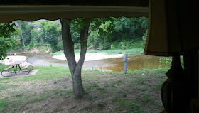
We had a nice view out our kitchen table of Sylamore Creek.

During the weekend, the park filled up and someone parked next to us, blocking our view. Luckily they left on Sunday, so we got it back.

I watch a Great Blue Heron  fish at this same spot every evening.

I actually saw him catch a fish, but didn't get a picture of it.

He/she had a couple of wounds on it's left side.

We saw many kids swim in the creek, which felt really good since we had temperatures that were in the high 90's the entire week we were at Holiday Mountain Resort. It is a nice resort, except that there is no phone signal ( You have to drive up the mountain for 3 miles before you get a signal),  no internet signal at your site, and you will be luckily if you get a satellite signal. The resort seemed to be neglecting the grass, as  it was about 3 inches long  in the campground, when we arrived, and 4 to 5 inches when we left. Tree limbs also had not been trimmed in a long time. We found our dryer vent cover broke after arriving. Joe said that it might have been broke when he had the motor home washed at a RV wash in Little Rock though. We don't know for sure, so we couldn't blame the park. Good thing someone will be taking it over soon. There are 113 RV sites, so it is a nice size park.