RVery Best Nest

Come join Joe, Mallery & I, as we travel around the USA in our RVery Best Nest. God's Favor has been chasing us down, and we are enjoying all of His blessing's, that He has created for all to enjoy!


Thursday, August 29, 2013

Great Lakes Shipwreck Museum

                                   Tuesday 8/20/2013
Part 2 of previous blog:
 We left the Tahquamenon Lower Falls and continued north on Hwy 123 until we came to the where the road ended at the most northeastern point of UP of Michigan, and where the Great Lakes Shipwreck Museum is located.

View of Whitefish Point Light Tower and the Light House Keepers Quarters.

It was a bit pricey at $13 per adult, but it supports the maintenance of the Whitefish Point Shipwreck Museum complex.


At the point, there is also the Whitefish Point Bird Observatory and the Seney National Wildlife Refuge, Whitefish Point Unit. (We didn't know these attractions were there also, but didn't have time anyway).
Sorry this picture is so bad, but I forgot to change to an inside setting on the camera. The picture shows some of the sights where ships sank along Whitefish Point in Lake Superior. There have been at least 6000 ships and 30,000 lives lost in the Great Lakes. One historian and mariner says there have been at least 25,000 lost ships in the Great Lakes. In the Whitefish Point area there have been 240 ships that have sank. Whitefish Point is called the graveyard of Lake Superior.

In the museum, this model of the 729 foot steel constructed Edmond Fitzgerald is one of the most recent ships that sank in 1975, taking all 29 crewmen down with it. The Whitefish Point Light Tower went out that night, leaving the "Fitz", out in the storm with no guiding light. It lies 17 miles northwest of Whitefish Point, at a depth of 535 feet.

A model of Whitefish Point Light Tower and Light-keepers Quarters.

In 2004 John Beck started a project to build the Edmond Fitzgerald with lego's to teach his class some history of Lake Superior. Nine years and over 18,000 lego pieces later, the project is almost done.
In the US Lifesaving Service Museum Building there is a replica of a 26 foot Beebe McClellan that was used during 1854 to 195 in the rescue of countless mariners in distress.

Whitefish Point has the most dangerous shoreline of the Great Lakes, so there were no less than four boat stations in the Whitefish Point area, making it the most concentrated number of stations anywhere on the Great Lakes.

This beach cart carried equipment that was drug to the shore to help with the rescue of mariners. This was the first and less risky rescue procedure used, before the Beebe McClellan was taken out on the water. The Beebe McClellan surfboat  endangered the rescuers lives as well as the ship survivors.

In the back of the cart is the life ring/ breeches that was attached to the ropes to rescue those who were on the sinking ship.

A canon ball with the rope attached, was shot out to the ship to create a lifeline.

Once the rope was anchored to a high point on the ship, the breeches buoy was pulled to shore with those in peril.

From the museum area there is a barrier free access to the shore of Lake Superior. Of course I had to pick up a Whitefish Point souvenir rock.

Your museum ticket also get you in the guided tour of the restored 1861 light-keepers quarters. If you want to climb the light tower it is an extra $4 with your museum ticket, or $5 without a museum ticket. The Whitefish Point Tower is still in operation and is the oldest active light tower on Lakes Superior. 
Joe stands by the 201 foot M.M. Drake's rudder and tiller, that sank in 1901 during a fierce northwestern storm. All crew were rescued moments before it sank. The wreckage of the Drake was first discovered by a dive team in 1978.


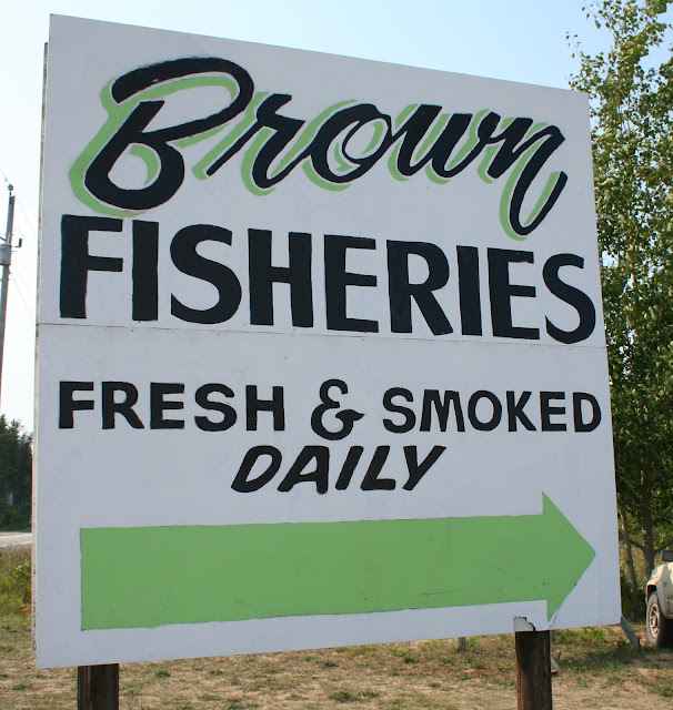
We left the Shipwreck Museum and drove back 11 miles to the small town of Paradise, where Joe stopped at Brown's Fisheries.
He bought some smoked salmon for $9 pound which was almost twice the price of what he has got it elsewhere in the UP.

Our drive from the Shipwreck Museum was 80 miles back to our campground. As we pulled in, the campground owner was going around and telling everyone that a storm was headed our way with golf ball hail. Because I didn't want hail damage to our Nest or Honda, I did what my mentor Kenneth Copeland teaches. I walked around our Nest and Honda and told the storm to go around our park to the north  and to the south. (Yes people probably think I am crazy talking to myself as I walk circles around our Nest- but I rather look crazy than have a dented up motor home and car). The Bible teaches us that Jesus told a storm to be still when he was crossing a sea in a boat with his disiples, and in the New Testament it tells us to command all things like Christ, and our Father will do the work. This is a picture of the sky about a half hour after we got home.

Later, I checked the radar on the internet and the storm had gone to the north and to the south of us, and our campground got a few sprinkles. Believe what you want, but if you have faith as a mustard seed, you can move mountains or storms! Amen!

Tuesday, August 27, 2013

Clementz's North Country Campground & Tahquamenon Falls State Park, MI.


After 4 nights in Munising, MI., it was time to go.There is a lot to do in this area and I wish we had more time because I would have liked to have taken the Glass Bottom Ship Wreak Cruise. There are 43 ships or boats at the bottom of the Munising Bay. There is also a boat ride called the Riptide Ride that goes around Grand Island that does a lot of 360 spins for fun. There are rivers near by that you can rent Kayaks, or take one of the fishing guides tours to catch Whitefish, Salmon, or Lake Trout in Lake Superior.
We took Hwy 28 east to the small town of Newberry, MI. and found our campground just north of Newberry.

 
Clementz's North Country Campground is located on Hwy. 123. The campground has gravel in roads and sites are on the grass. The park has a few full hook up sites, but there wasn't any available when we made our reservations.We paid $31 a night with our Good Sam membership. They have free WiFi, but if you are loading pictures, you will get maybe a evening, then the WiFi shuts you down. (In other words you are limited on usage). The park is located in a good place for a  couple attractions in the area.

There was an Air Stream Caravan with about 20 of them staying in our park.

The day after we arrived in Newberry, we took Hwy 123 North to Tahquamenon Falls State Park. The drive was about 30 miles from our campground.

From the parking lot to the overlook, the walk is about 1/3 of a mile on a nice paved paths.
But if you want to see the falls up close and personal you have to go down 94 stairs.

Tahquamenon Upper Falls is Michigan's premier waterfall.

In the spring nearly 40,000 gallons of water per second cascade down over the edge of the 500 million year old sandstone.

The water is brown because it has a lot of  dissolved minerals including tannins from the barks of hemlocks, cedars, & spruce trees.
  
Dogs are allowed on the trails to the fall, but we were glad we didn't bring Mallery, because the 94 stairs had holes in the steps, and her little paws would have fallen through. Guess who would have to carry her all the way down and then back up! 
Back at the top, we walked down another path and found another viewing spot of the Upper Falls.

Further down we found another place where you could take more stairs to yet another viewing spot. We talked about whether we wanted to do another climb back up so many stairs.

We decided to give it a try.
 
The viewing spot gives you a full view of the falls.

The Upper Falls is 200 feet wide with a 50 foot drop. The highest recorded flow was on May 10, 1960 with a flow of 52,228 gallons of water per second.

The long climb back up the stairs was strenuous, but we did better than I thought we would. (I guess our 3 times a week 30 minute exercises routine, that Joe and I started doing 3 months ago- esp the lunges- is really helping). After reaching the parking lot, I decided to check out the gift shop, and Joe went to the Brewery and Pub.

After shopping I went to the pub to find Joe.

The pub also has a restaurant if you forgot your lunch.

I found Joe enjoying the Black Bear Stout.

The Brewery has 3 beers. I tried the Blueberry Ale and it has a wonderful clean and crisp taste with a touch of blueberry. I am not a big beer drinker, but this one was so good. I asked if they had 6 packs of the beers to go, but they told me that they don't pasteurize the beer, so it can't be sold to go. That is why I like non- pasteurized goats milk. Every thing is better when it isn't pasteurized.

We left the Upper Falls and drove further north to the Lower Falls.
At the Lower Falls, you can rent a boat and row over to the other side see more of the falls. The rowing distance is only 300 feet.

If you don't want to rent a boat, there is a boardwalk you can take to see the main Lower Falls.

The main Lower Falls.

Further up the boardwalk is still more of the Lower Falls.

If you want to keep following a trail, you can hike another 4 miles to the Upper Falls.
                                 To be Continued:

Monday, August 26, 2013

Wagner Falls & Grand Island, MI.


                                Sunday 8/18/2013

This Munising Front Range Light was located right on Hwy. 28 as we were headed toward downtown Munising from the west. There is also a Munising Rear Range Light a few blocks south of this light. Both the front and rear light replaced the Grand Island East Channel Light in 1905. The Light is managed by the National Parks Service at this time. The grounds are open to the public, but the tower is closed. Mariners use both the lights to know if they are to the left or right or in line of the ranges.


We spent the day driving to see a lakefront property on 16 Mile Lake, and on the way home we stopped at the Wagner Falls. It is located off Hwy 94, just southeast of Munising.


The trail to the falls is very short, probably less than 1/4 of a mile.


It is a pretty nice fall and worth the short walk in.
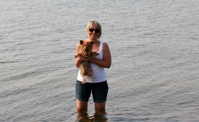
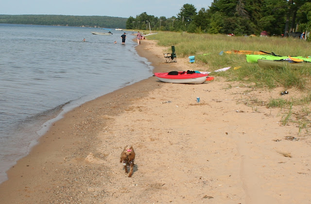
When we got home, I wanted to go to our beach in the RV park and collect a few Lake Superior rocks. When I first got into the water, it was cold, but in a very short time, it felt refreshing because it was a hot day. Mallery likes to be with me, so she ran into the water up to her tummy before she headed back to the shoreline.
Then because she was so cold she ran up and down the beach and got all sandy.


Before we went back to the Nest, I had to dip her in deeper water to get all the sand off of her. Joe had to go to the Nest to get a towel before I dipped her because I knew she would be cold. If we had sewer hook up at our site, I could have just given her a bath back home. We only had electric and water for the four nights, and our grey tank was getting close to full. This is a picture before I dipped her up to her mid back. She shook all the way back to the Nest in her towel! Poor baby.


The next day we had made reservations to go to Grand Island. The ferry is located at Powell Point, about a 1/4 mile from our campground, Tourist Park Campground. We went back and forth trying to decided whether to take the bus tour for $22 each (which included the ferry ride), or to rent some bikes once we got over to the island. Because it was forecasted to be a hot day, we decided to take the bus tour, and forgo the exercise.


We signed up for the 11:00 ferry ride and the 12:00 bus tour on the island.


The ferry ride over to the Grand Island takes maybe 3 minutes max.


There are Black bears on the island. I guess they, as well as deer,
 swim back and forth to the island at night.


Once over on the island we had to wait an hour for our bus tour. There was a visitor center with lots of exhibits about the island's history. This is a picture of the shape of Grand Island with legs.
The Trout Bay was used from 1905 to 1956 to bring guests, and supplies to the Island.


Once on the bus tour we and 4 other couples were driven to beaches, present day private cottages, and a few park owned cottages. The Ojibwa or Chippewa Indians first used the island for a summer home. In the early 1800's, fur trappers built small cabins along side the Chippewa who were very friendly. Abraham Williams was one of the first Europeans to settle on the island. One of Williams descendants married a Powell, so there were Williams and Powell's on the island. We visited a cemetery that had only Williams and Powell family members buried in it. Joe and I didn't stay long in the cemetery because the mosquitoes were biting. If you visit Grand Island don't forget your insect repellent.


This was a stop at one of the beaches.


I believe this is Trout Bay.


It had very calm waters for swimming.


Our tour then took us to the west side of Grand Island to Mather Lodge. William Mather & Cleveland Cliff Iron Company purchased the island in 1900, except for the few private owned cottages. Mather built a resort for many of the wealthy businessmen from his company and friends.

It was much more breezy on this side of the island.


 Mather used this as his main resident as well as his hunting lodge.


He built a wild exotic game preserve on much of the northern island for hunting/ and the protein served in the resort. The US Forest Service purchased this property in 2012 making it available for viewing to the public. If you are hiking or biking, you will not get to tour the inside of the Mather Lodge. Viewing it is only for those on the bus tour.


Our last stop was at Waterfalls Beach Overlook. We were given about 30 minutes on the beach or walk a nearby trail. We went to the beach and I waded in the water and collected a few rocks.


Then we went to the trail for the last 15 minutes. The trail runs along the west shoreline.
Along the trail we came upon an area with mounds of green moss.
Many of the mounds of moss were the size of a basketball.
There were a mixture of different mushrooms along the trail also. It was a beautiful trail but the mosquitoes were attacking me like crazy.
After our 3 hour tour, we took the ferry back to the mainland. I took this last picture of what once was Abraham Williams home, and during the "Resort Era", it was part of the hotel. When the US Forest Service purchased the island, the private cottage owners were allowed to stay. One cottage on the island has been past down for 7 generations. 
Our tour guide was very good with a wealth of history and information. The island is very rugged with no food or water available, so be sure to bring what you need. We were both glad we took the bus, because the mosquitoes were bad and it would have been much too hot that day. If you want to hike or bike the trails, I suggest waiting for fall when the color is better and the mosquitoes have died off. To bike around the whole island, signs say it is 21 miles and plan on 6 hours of biking. There are a couple of shorter routes, one a 12 mile which takes 3-6 hours, and a 8 mile that takes 2-4 hours.