 |
| Another try at stopping at the scenic stops on the Kancamagus Highway. |
 |
| The views are much better, but not as clear as they can be. |
 |
| Pemigewasset Overlook. |
 |
| Close up of Pemigewasset Overlook. |
 |
| The next scenic overlook. |
 |
| We are at 2,855 ' of elevation. |
 |
| A sign tells us that for every 1000 feet of elevation gain is like traveling north 290 miles. |
 |
| The Kancamagus Pass is the highest point on this Scenic Byway, and the headwaters of two river systems start here. |
 |
| Sugar Hill Scenic Vista. |
 |
| The tallest mountain to the left in the picture is Green's cliff, which is at 2926 ' and 1.9 miles away. |
 |
| We stopped to do a trail, and found that dogs are allowed on the trails. This is a first for us. In all our travels, we have never seen where dogs are allowed on the trails. |
 |
| We did the Sabbaday Falls. We didn't bring Mallery this day, but she would have enjoyed it, because it is shaded and very short. |
 |
| It was a nice wide trail with a gradual incline. |
 |
| We followed a pretty dry rocky stream to the Lower Pool. |
 |
| A pretty green color. |
 |
| But very clear also. |
 |
| Here is the gorge or flume. There's always an adventuresome person standing or climbing on the edge where ever we go. |
 |
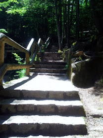
| A few steps to the top of the falls. |
 |
| A look down the flume from a bridge. |
 |
| Another angle from the bridge. |
 |
| I went back down half the stairs, to get another angle of the falls. Joe is standing beyond the bridge |
 |
| A view of the bridge to the falls. |
 |
| A view above the bridge. |
 |
| Above the falls, people were hanging out on the rocks, or climbing across the stream on the rocks. |
 |
| Farther up beyond the falls. |
 |
| We walked back down the trail, got our lunch, and came back to this shaded area by the stream to eat. To be continued. |


No comments:
Post a Comment