


Friday 8/31/2012
 |
| Still in Forks, WA we took a day drive north on Hwy 101 |
 |
| We take Hwy. 101 to Hwy. 12 and then Hwy. 13 through a couple of towns. After we go through the town of Clallam Bay, we got our first views of Vancouver Island of British Columbia. |
 |
| I got Joe to make a stop, so I could get a better picture that was not blurry. |
 |
| As we continued on Hwy. 112, we saw signs telling us there was a pull out viewing stop. |
 |
| The pull out gives you a view of the town of Sekiu. |
 |
| This zoom give you a close up of Olson's RV Park along the Strait of Juan de Fuca. |
 |
| Olson's has another area of it's park further into the town. Motel Trailer Park is another park that sits on a hill looking over the water and the other section of Olson's RV Park. The town of Sekiu seemed to be a town of only motels, and RV camping. There was one or two restaurants and that seem to be it. There is a small population that lives in Sekiu year round. |
 |
| We continued east on Hwy. 112, with me trying to capture pictures as Joe drove. |
 |
| Can you see the man with a hat in the boulder, in the picture I captured as we drove by? |
 |
| Of course we had to sit for 20 minutes for road work that day! |
 |
| The road crew man that held us up with the stop sign, told us he saw a whale the previous day swimming near the shore in the kelp. |
 |
| We were told there was a very nice Tribal Museum in the Makah Indian Reservation in the town of Neah Bay. We didn't stop, because we don't get up early enough to do a full day of sight seeing. |
 |
| Indian statues as we enter into Neah Bay, WA. |
 |
| Welcome sign to Neah Bay, and a list of business in the town. |
 |
| Neah Bay Harbor as we drive into the town. Our campground owner of Forks 101 RV Park gave us a day pass to enter into the reservation. If you do not have a pass, you must stop and purchase one for $10. |
 |
| The drive from downtown Neah Bay to the parking lot of Cape Flattery Lookout is approximately 8 miles. From the parking lot there is a short trail to the lookout. |
 |
| The trail is partly on a cedar wood path in the low areas. |
 |
| Of course there has been a cougar sighted here in the past. I tell Joe to stay close to me, because I am short and might be mistaken as a child to a cougar! |
 |
| The first platform lookout, looking south. |
 |
| We carry on through the woods. |
 |
| And of course bears could be lurking here in the wilderness. There were a fair number of other hikers that day, so I felt better. |
 |
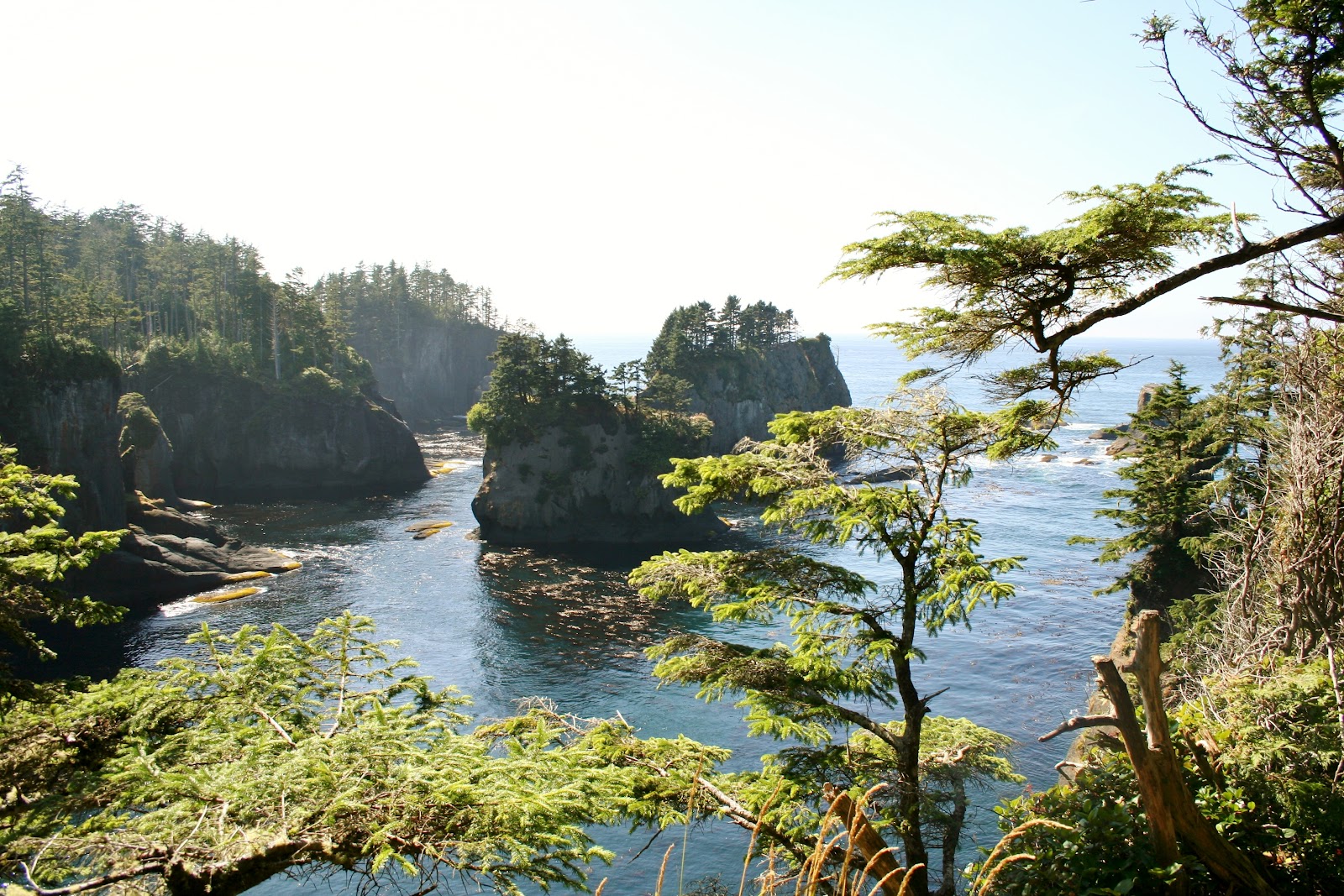
| Another lookout, but this one to the north. This is a view of some of the sea caves that have been made from the constant pounding of the ocean waves. Do you see the cruise ship out at sea? |
 |
| I zoomed in for you, because you could barely see it in the previous picture. |
 |
| By the time I got my zoom lens on, the cruise ship had almost slipped away behind the evergreen tree. |
 |
| At this lookout a sign tells us that there are sea caves below us and in the future this land will be gone.Someday the sea will collapse the sea caves and the ground we were standing on. |
 |
| The last lookout is at the point. This point is the very most northwesterly tip of the continent. Looking south again in this picture. |
 |
| Looking straight west from the point out to Tatoosh Island Lighthouse. |
 |
| Looking north from the tip point. |
 |
| I zoomed in from the previous picture so you could see the boat and cruise ship that I could see with my naked eye. |
 |
| Cruise ship with Vancouver as the background. |
 |
| Close up of Tatoosh Island Lighthouse. |
 |
 |
| A guy ask Joe and I if we are birders. I tell him no, but we have a sister/sister in law and friend who are. He points out a bird below. Joe gets the binoculars and I get my zoom lens on. |
 |
| It was an Oyster Catcher. |
 |
| I have seen this bird on my friend Dawn's blog, but I have never got a picture of one. It was so far away, the only pictures I got were still far away. I cropped this picture on blogger so it would be visible, but cropping made it blurry. As you can see the Oyster Catcher has an orange bill and eyes. |
 |
| More birds on the island rock in the far distance, and unable to see what kind they are with our equipment. |
 |
| Another rock island had some sea lions on it. |
 |
| Even though the trail is short, there are many areas that are very uneven with many obstacles. Not a good trail for those who have trouble walking and stumble easily. |
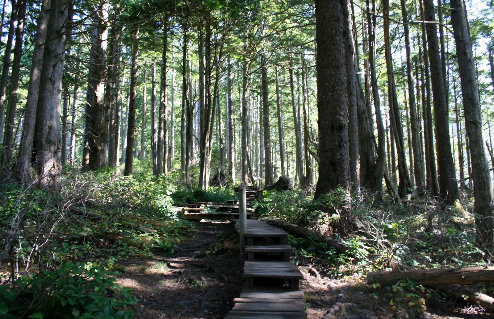 |
| The trail is mostly up hill going back. |
 |
| The trail is 3/4 of a mile to the lookout. |
 |
| Dogs are allowed on the trail. We didn't bring Mallery because we didn't know if dogs were allowed. |
 |
| In the parking lot you can get a hot dog or soda at the Northwestern Cafe. |
 |
| Views on the way back to Neah Bay. |
 |
| Marina in Neah Bay as we go through the town. |
 |
 |
| Throughout the town of Neah Bay there were sign for the teenagers, from not taking drugs, and not drink and drive and so on. |
 |
| We made one stop on Hwy 112 to looked back west at the coast along the Strait of Juan de Fuca. |
 |
| Fog was setting in on the strait as the day got later. |
 |
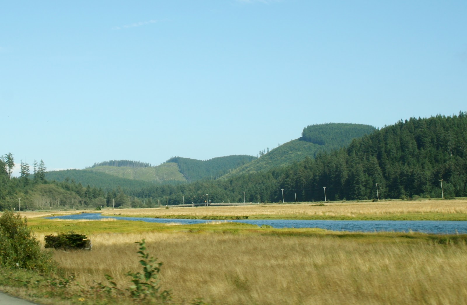
| The drive was a long 60 miles back to Forks, WA. |
 |
| Joe spotted this sign that tells how long it takes from planting a tree to harvesting it, in the northwest. |
 |
| We arrive back to our new hometown for the week. |
 |
| Forks is the Twilight Capitol of the World, where vampires and werewolves are welcome and shirts are optional. |
 |
| Have you figured out what Forks, WA is significant for yet? |
 |
| Clues! |
No comments:
Post a Comment