Friday 9/14/2012
 |
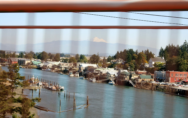
| I got a good view of La Conner and Mount Baker from Rainbow Bridge, minus the blur from the bridge rails. |
 |
| On the other side of Rainbow Bridge is the Swinomish Indian Reservation. |
 |
| Once we got on the main section of Fidalgo Island, we took Hwy 20 south past Lake Campbell. |
 |
| A few miles further south we came to Deception Pass. We parked and got out to look around. Before the two bridges were built, the only way to get across was by boat. |
 |
| We were on the north side of the bridge on Bowman Hill on Fidalgo Island. After a few pictures, we drove across to the Whidbey Island side of Deception Pass. |
 |
| Looking across, we could see a beach on Whidbey Island. |
 |
| It is called the North Beach according to the map. |
 |
| We drove across the pass and had to pay $10 for parking. This picture shows the two bridges going across Deception Pass. |
 |
| I walked out a little bit, but I had Mallery in my arms, and every time a car whizzed by, she would jump in my arms. |
 |
| I took this one picture looking west from the pass, then gave Joe the camera. |
 |
| If you wanted to go to the other side of the bridge, you had to go down some stairs, and then under the bridge. |
 |
| Joe went under the bridge and took this picture looking east at the pass. |
 |
| Strawberry Island out in the distance. |
 |
| I cropped one of Joe's pictures to give me a close up of a housing district on the southeast coast of Fidalgo Island. |
 |
| At one time the two islands were thought to be a peninsula until further exploration. |
 |
| There is a path that takes you down to North Beach from the parking lot on the Whidbey Island side. |
 |
| View after walking half way down the path. |
 |
| Closer yet. |
 |
| At the bottom of the trail, the path takes you through some pines trees. |
 |
| View of Deception Pass Bridge from North Beach on Whidbey Island. |
 |
| Joe brought our lunch down the path, so we enjoyed it while sitting in the sun on this log. |
 |
| Mallery trying to find shade behind her dad. To be continued: |


No comments:
Post a Comment