Saturday 9/7/2013
 |
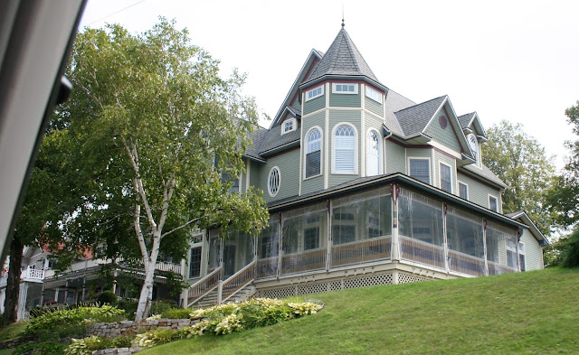
| On one of our last days in Petoskey, we decided to check out a few more lake in the area. As we headed north through Petoskey, I took some pictures of 3 homes on the main road. |
 |
| Such detail, |
 |
| but this one takes the cake! |
 |
| We took Hwy 31, and then turned on M-119 toward Harbor Springs. The little blue dot just east of Harbor Springs is Round Lake, which we were headed for. |
 |
| Round Lake is rather small at 353 or 475 acres ( I get mixed information on the internet on the size) and 4 miles of shoreline. |
 |
| It does sit at a higher elevation at 781 feet. I couldn't find out much about the lake except the Sturgeon River flows into Round Lake, or water flows out of Round Lake to Sturgeon River. |
 |
| The beach at Petoskey State Park is really nice though. |
 |
| Looking toward Harbor Springs from the beach. |
 |
| Next we drove around the south side of Crooked Lake to the end of the road. This part of the lake was a bit weedy. |
 |
| After Crooked Lake we drove to Burt Lake State Park. |
 |
| Burt Lake is a large lake at 17,120 acres with a maximum depth of 73 feet. |
 |
| Burt Lake is 10 miles long and 5 miles wide, with rivers flowing in and out of the lake. Burt Lake is also connected to several lakes making it a chain lake. |
 |
| We left Burt Lake and drove west on Hwy. 68 to the Hwy. 31 and drove along the north side of Crooked Lake. (My finger just points out Petoskey in reference to the lakes). |
 |
| This map shows our route on Hwy. 31 along north Crooked Lake. |
 |
| View of Crooked Lake from north shore. |
 |
| It has a small back yard. ( We want a home where we can park the motor home next to the house to have more bedrooms available for company). |
 |
| It also has a dock and boat lift. |


No comments:
Post a Comment