RVery Best Nest

Come join Joe, Mallery & I, as we travel around the USA in our RVery Best Nest. God's Favor has been chasing us down, and we are enjoying all of His blessing's, that He has created for all to enjoy!


Showing posts with label North Carolina. Show all posts

Friday, May 9, 2014

Stone Mountain State Park, North Carolina - Part 2


                                  Saturday 5/3/2014


We left the Blue Ridge Parkway via Hwy 18.
There are some steep grades going down, but all in all not too bad.

We cross the Eastern Continental Divide at 3060 feet.
A few views on the way down.
At about 1,700 feet we came to a small community of McGrady. We were looking for the road on the map that went to Stone Mountain. The map didn't give a road name or highway number, so we had to find someone in McGrady who could confirm the road we thought was the right road.
Once confirmed we were right, we turned back a mile to the road.

Longbottom Rd will take you to Stone Mountain, if you decide to do the same loop drive we did that day.
The drive on Longbottom Road was a very quiet and peaceful Drive with little to no traffic. True country driving. It looked like to us, that the hill ahead had been logged. I sure wouldn't want the hill behind my home logged. A good way to cause a landslide down on the house.
After a 15 minute drive we came to the back entrance into Stone Mountain State Park.
After driving in on a gravel road for about 3 miles we came to the lower parking lot, but we continued down the road looking for the park office to get a map of the park. Then we came to the upper parking lot. I told Joe we should stop and see what was there. After using the restroom we found this sign telling us the falls was not too far to walk to.
At about a mile we came to the top of the falls.
A few steps down to the top of the falls.
Railing with sign telling you to not cross the fence as stream is slippery at the top of the falls.
We walked down 72 stairs to a landing at just below the top of the falls.
View from platform looking down.
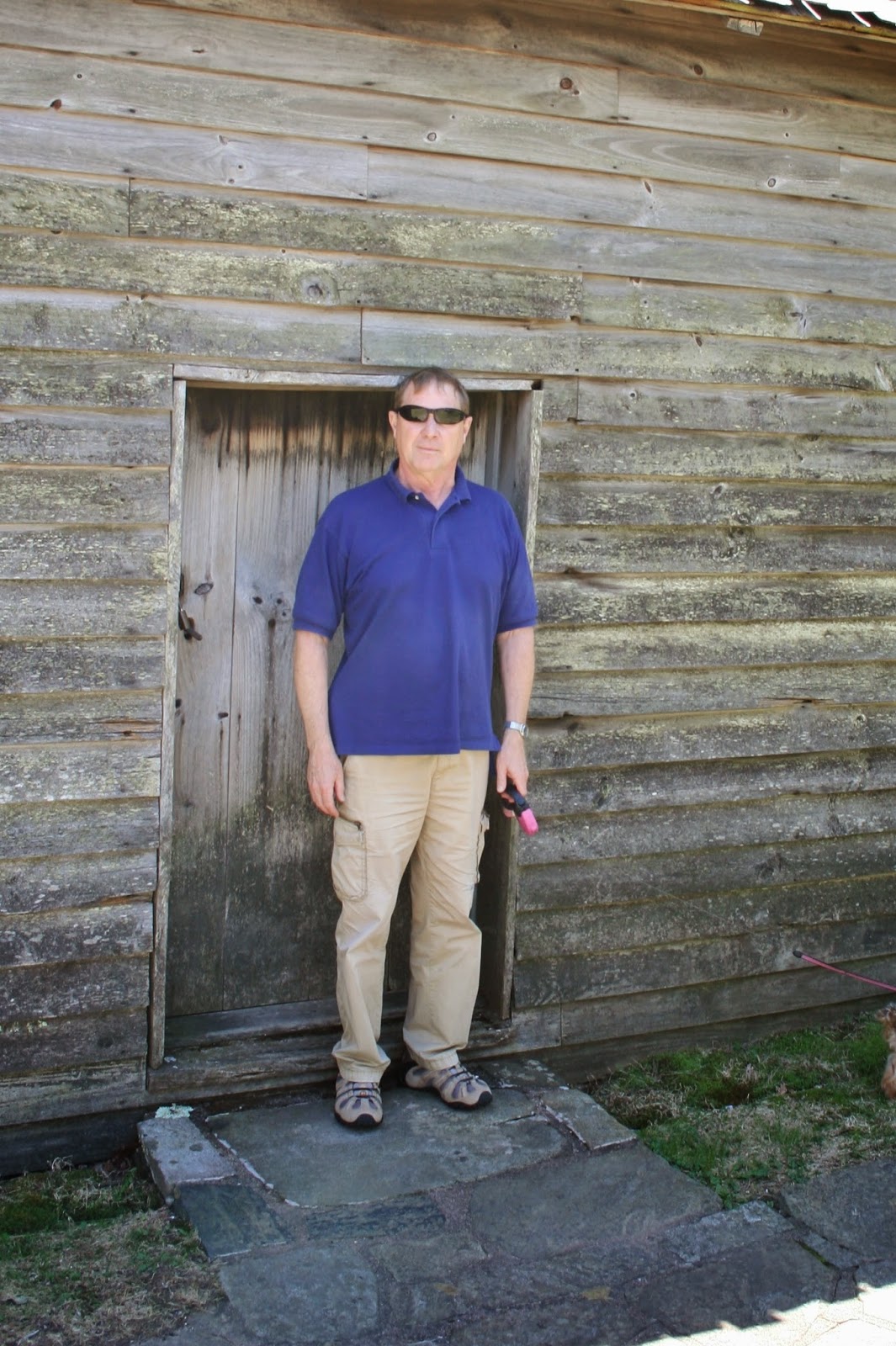
More stairs to the bottom of the falls. Joe decided to stay at the landing with Mallery. It was very warm and Mallery would have to be carried down and up the stairs. Joe also has been having problems with a foot. Because he has been not over working his foot, it has been getting better. Going down more stairs and back up, would only start the healing process all over again.
I took the stairs down to the bottom.
A family was at the bottom cooling off in the water.
I took this picture with a boy at the bottom of the falls so you could get a perspective of the height of the falls.
I counted the stairs as I climbed back up them. There are several landings and one with benches to stop for a breather.
After picking up Joe and Mallery at the first landing, we headed back up the top steps to the trail. Total stairs, 325 in all. You don't climb that many stairs when you are out of shape without getting a hip cramp that makes you jump off the potty the next day, and muscle and joint pain that wakes you through the night. 
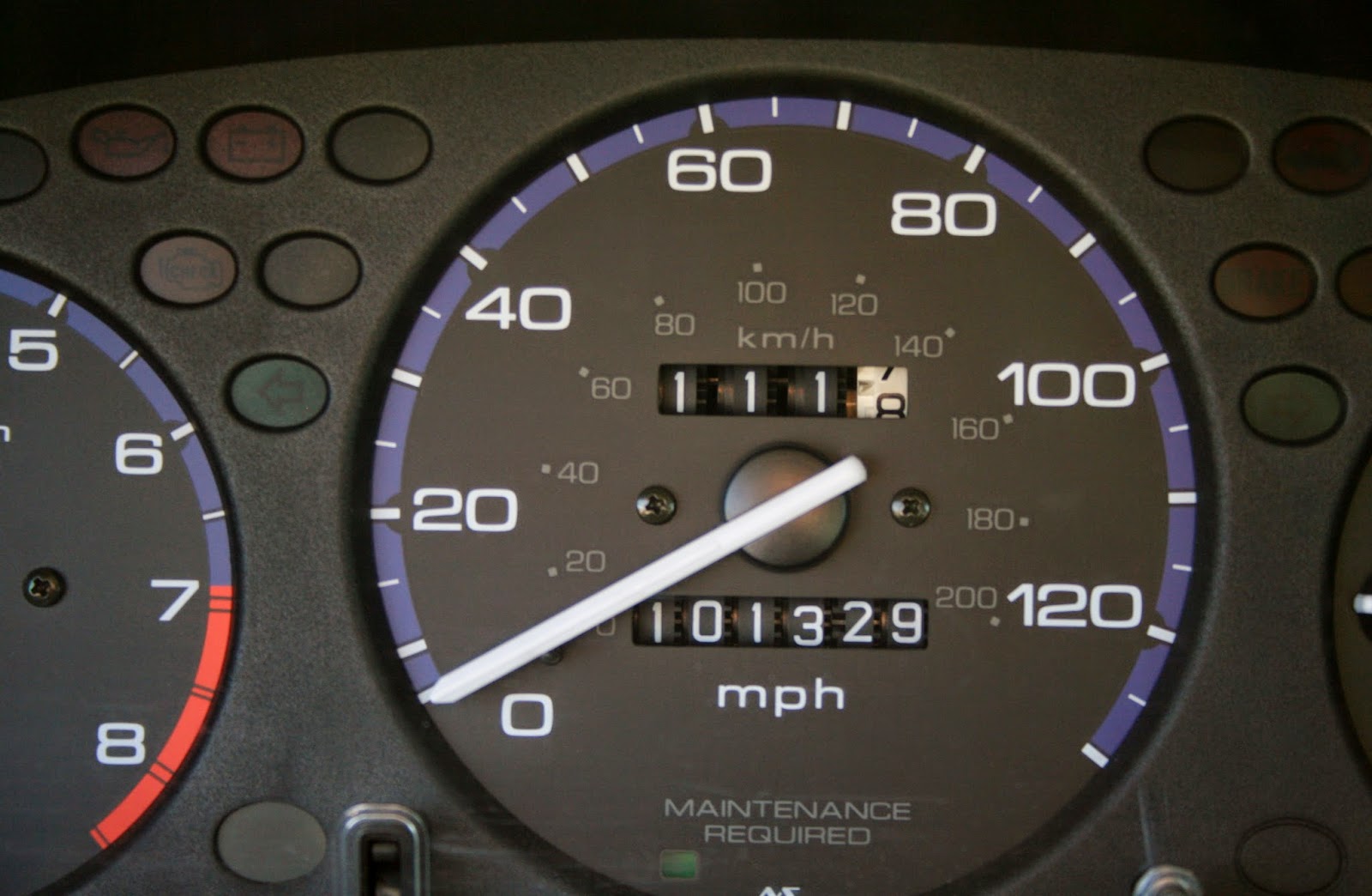
We didn't get home that night until close to 7PM. Our total day drive was 111 miles. Oh and by the way, on the way out of the main entrance of the park we stopped at the park office. We were told we should have stopped at the lower parking lot. At that parking lot, there was a 1/2 mile hike to Stone Mountain. Since by the time we got back from the falls and park office, it was getting to late to go back to the lower parking lot. The picture below is a picture of Stone Mountain that I copied from the internet that we would have seen had we walked the trail from the lower parking lot.
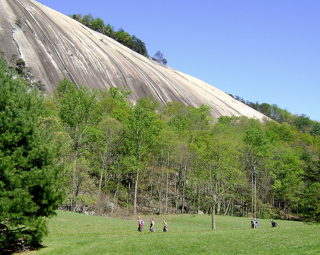
Thursday, May 8, 2014

Last Blue Ridge Parkway Drive South Of Hwy 89


                                   Saturday 5/3/2014

On our last day in the Mount Airy area, we decided to take one last drive up to to the Blue Ridge Parkway.
We took Hwy 89 up to the parkway.
On the way up we drove across the border into Virginia.
After a mile going south on the parkway, we entered back into North Carolina.
We stopped at the overlook that we had stopped at the last time we had driven on the parkway. The sky was much more clear than the last time we were up at this overlook. (This is Joe, and I would love to build a house here and have this as the view out on the patio. Maybe someday). Joe like to make comments once in a while when he does a blog check for me.
After we left the overlook, we were on a new road on the parkway, that we had not seen yet. We drove a long ways, with no more overlooks. The drive was just forest on both sides of the road. We finally came to this stop, so we had lunch by the pond. Joe was getting frustrated with no overlooks and lots of driving.
After lunch, we left the pond spot and just down the road a mile we came to this overlook with a picnic table. Darn, we should have waited.
The overlook has a view of Stone Mountain below. (The white patch)
Next stop Mahogany Rock Overlook.
These views are looking west from the parkway.
Close up of Christmas tree farms and homes in the Whitehead community area we think.
Devils Garden Overlook
This view is looking northeast from the parkway.
Air Bellows Overlook- the best overlook of the day.

It has a very expansive view.
I took 4 pictures to get the entire view, but only posted this one.
Close up of previous picture.
Another close up looking in another direction The views were like you see in a hot air balloon ride. Yes Joe and I have been in a hot air balloon, so we know what it looks and feels like.
We continued down the road and came to this turn out that had the old preserved Brinegar Mountain Cabin.

In 1876, 21 year old Martin Brinegar bought this 125 acres for $200. Two years later he married 16 year old Caroline, and they homestead in this home.
The door to the cabin makes me feel taller!
The door in the cabin makes Joe feel real tall! The doors were made short to help get the warmth in during the cold winter, not because they were short people. Martin was 6'3" tall.
Next to the cabin, there was a outdoor pantry where herbs were hung and dried, as well as dried corn, and cured meat.
Back view of cabin.
Under the outdoor pantry is the root cellar where fruits and vegetables were stored through the winter. At age 68 Martin Brinegar died of pneumonia. The state of North Carolina bought the land in 1935, and even though Caroline had a lifetime tenure of the home and land, she left to live with her daughter because she thought it had become to noisy on the parkway.
At mile marker 241 there is a state campground for tents and RV's.
Further down the road we came to the Bluffs at Doughton Park.
Everything was closed, but it looked like rooms to rent for the night after long drives along the parkway.
Joe and I can't believe how everything is still closed along the parkway, even at the first week of May.
The view from the Bluffs was not so great, but it is right on the parkway, so if you are tired, you can not be too picky because there is not much to pick from.
Basin Cove Overlook was our last stop.
Another view of Stone Mountain in the distance. There is also a trailhead at this overlook.
Close up of Stone Mountain.
 As we left Joe mentioned the awesome view on the other side of the sign. I got a glance of it and realized I missed the main view at Basin Cove. I guess I was fixated on Stone Mountain. Sorry, but as Joe said, for pictures, they all become about the same anyway!
As we continued south we went past Miller's Camping, a private campground.
It looked like a lot of RV's that are left there all summer to get to higher ground during the hot summers.
We came to Hwy 18 and turned south toward N. Wilksboro. 
To be Continued:
We arrive to Marietta, Ohio today and will stay here for 3 nights to wait out the coming rain before we continue north. It has been really hot the last few days in the high 80's and low 90's.