RVery Best Nest

Come join Joe, Mallery & I, as we travel around the USA in our RVery Best Nest. God's Favor has been chasing us down, and we are enjoying all of His blessing's, that He has created for all to enjoy!


Showing posts with label California. Show all posts

Monday, July 16, 2012

Jedediah Smith Redwoods State Park

Saturday 6/16/2012

After stopping at the Redwood Park Headquarters for information in Crescent City we drove NE to the Jedediah Smith Redwoods State Park.

Joe was told by a ranger at the headquarters that the road in the park is the same road that was used during stage coach days.

The redwood trees didn't have the same enormous look as the sequoia's trees did, but because of their height, they are the largest living thing on earth.
They can grow up to heights of  375 feet.
The road was narrow in some spots.

There is no charge into the park.
The Redwood Forest contains more biomass per square foot than any other area on earth, which includes the Amazonian rain forest.

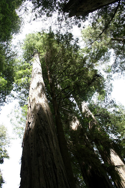
This is a picture of half of a redwood tree. I just couldn't fit it all in one picture.

Some of them can be as much as twenty feet in diameter. Redwoods use to be found world wide 1000's of years ago. There are three classified redwoods.  These redwoods in the picture are the Coastal Redwoods. The Sierra Redwood are located in small separate groves in the Sierra's. The Dawn Redwoods are found confined to a small valley in central China.

The Coastal Redwoods are found in a narrow strip on the northern coast of California.
Views off Hwy. 101 on the way home.


This home along the rugged coastline was once a ranch owned for 60 years by Louis and Agnes De Martin. Mr. & Mrs. De Martin would cook warm meals and provide beds for 50 cents a day, for people traveling from Eureka to Crescent City. Now it is an American Youth Hostel for travelers from around the world.
This is a nice beach just north of Klamath, CA.
It was close to dinner time, so we didn't have time to do anything but take some pictures.
There were a few people enjoying the beach, even though it was a bit cool.


Saturday, July 14, 2012

Crescent City, CA.

Saturday 6/16/2012


Trees Of Mystery is just a few miles north of Klamath, CA.

Paul Bunyan and Babe the Blue Ox, got our attention as we drove up Hwy. 101 for a day drive from Klamath.

This is the third Paul Bunyan we have seen in our travels. One in Bemidji, Minnesota, one in Three Rivers, CA., and this one in Klamath, CA.

Here is some information with the size of the Klamath Paul Bunyan. When you see Paul Bunyan, you are at the Trees Of Mystery. We had Mallery with us and dogs are not allowed in, so we couldn't go in.. There are gondola rides with a vertical rise of 571 feet up, and to an altitude of 742 feet. Trees Of Mystery also has a Native American Museum, a Forest Cafe, Motel Trees, and a gift shop. For more information go to their website at http://www.treesofmystery.net/

We continued up Hwy. 101 and entered into the Redwood National and State Parks.

At the Redwood National and State Park sign, there is a good viewing spot of Crescent City Harbor CA.

I zoomed in to see the lighthouse, but it didn't show up well, so we got out our new zoom lens.

Much better with the new lens. The new lens has been coming in handy for many pictures.

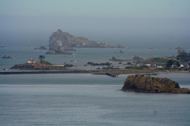
Battery Point Lighthouse

Our next stop was at the Crescent City Beach for our sack lunch.

As you can tell by the way Joe is dressed, it was a bit cool.

Looking south down the beach. Our next stop was to Crescent Beach Overlook, on top of the foothill in this picture.

Crescent Beach Overlook

Looking south again.

Zoomed in

A wedding was to begin on the Overlook in about 15 minutes, so the deck was taped off.

Zoomed in to the north from the side of the deck.

All the trees in this area have moss hanging from them. I guess from all the moisture they get on the coast.

Downtown Crescent City had a pier/ jetty we drove out on. This is a view of a downtown beach. There were a few beach goers, and a few:

 surfers.

In the Crescent City Harbor  Park, we found this lovely carved:

mermaid

We also got a closer view of Battery Point Lighthouse.

There were some pretty pink geraniums lining the harbor for this shot of the lighthouse.

The zoom lens helped out once again.

There was a group of locals drinking and playing instruments in the middle of Crescent City Harbor Park.

The Park Headquarters Information is located at 1111 Second St. in Crescent City. We stopped by to get maps and park information. I found this picture of the waterfront of Crescent City, CA. after  the 1960 tsunami.

To be continued:

 We are still currently in Junction City, OR. sitting at the Guaranty RV Super Center's RV Park across the street. We had planned on leaving here on Sunday, but because of some delays, we won't be leaving until hopefully Tuesday.

Monday, July 9, 2012

Klamath Coast Drive, Klamath, CA.

Friday 6/15/2012

While at Klamath River RV Park, we took the 2 mile Coastal Drive. At the entrance you see this bear. There are 8 legendary bear statues that have stood in the area since 1925. These monuments remind visitors and residents of Klamath's rich diverse history , culture in a setting of natural beauty.

The camp host at Klamath River RV Park told Joe about this trail that takes you past the river and then to the ocean.
As we walk along the trail, we notice a sign asking visitors to respect the Yurok Indian's ceremony land and buildings.
Looks like the area had not been used for a while.
As we got to the beach, a couple told us they had seen a bunch of seals close to the river mouth. The big rock on the beach on the south end of the mouth of the Klamath River is called sister rock. It is said to be the sister spirit of a rock I will tell you about later.
It was extremely windy that day, and sand was blowing at us. Not much fun! It tends to be windy in this area.
We spotted the seals, and Joe headed for them. He looked back for me,
I was checking out rocks and drift wood.
The Klamath River is the second largest river in California that runs about three hundred miles from Oregon to the Pacific Ocean in Klamath.
Joe stopped and waited for me, before going any closer.
As we walked up closer, they all started to dash for the water.
We backed way up, and they calmed back down.
I sat on the ground and inched myself closer and closer on my bum every 3 minutes or so. All eyes were on me
I couldn't believe how almost every seal kept an eye on me the entire time!
I was using my zoom to get these pictures, so I was not that close
Even on my bum, when I got about 50 yards away, they headed for the water
At that point I backed up and they calmed down again.
The water in this small bay was very clear.
Klamath River is world famous for Chinook Salmon and Steelhead fishing.
As we walked back to the trail, I said to Joe, "Look someone is snorkeling"! Joe said it was a stick.
I zoomed in and took a picture. After I uploaded this pictures, I decided Joe was right.
Just up from the trail we found a pull out and parked the car.
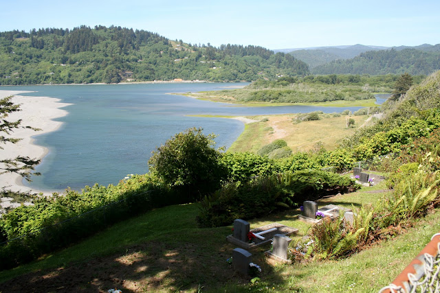
We got a great view of where we had just been walking.
The river flows from the upper right, out to the ocean at the upper left.  There was a small cemetery below us.
This is a picture that was posted at the lookout with a Yurok Indian story. According to the Yurok, a spirit named Oregos wanted to help the area people. She chose to be the tall rock on the north bank of the mouth of Klamath River that resembles an old women carrying a burden basket on her back.

Orego's is located in the upper portion of the picture, on the north bank of the Klamath River.
Here is a zoom of the previous picture. Orego's summons the fish in to provide food for the people.

Straight down from the bluff is the Pacific that we could not see when we were walking along the river bay.
After the bluff lookout spot, RV and Trailers are prohibited any farther on the Coast Drive.
The road is very narrow and ruff.
On the drive, there are peeks of the ocean between all the fauna.
The next turn out was a parking area for the walk in Flint Ridge Campground and Trail. The trail is 9 miles round trip.
At the trail head for the trail and campground there was a sign that stated bears have been seen on this trail and campground.
From the parking lot we got the next two pictures.
The next pull out stops at a farm buildings that use to house an early warning radar station, against Japanese submarines that occupied Oregon and California waters off shore during World War 2.
The window had slits that  two 50 caliber machine guns could be shot from.
At the entrance of High Bluff Overlook, we had to drive the Honda quite a distance down through the forest to get to the actual parking area.
From the parking lot there is a very short walk to the overlook.
Zoomed in.
The strongest earthquakes on earth are produced along this coastline.
There was another trail which was located north from the parking lot. This trail was about 1/3 mile long. On the trail, I saw a guy taking a picture of something. As we approached him, he left. I looked down and saw this little guy/gal.
I had so much fun watching this snail roll and slide across the ground. As it moved it rolled side to side.
You can actually see its mouth and nose. ( That's what they look like to me anyway).
When we got to the end of the trail, this was the view looking north.
On the way back up the trail, I told Joe to be careful not to step on the snail.
I had to take a couple more pictures of the snail. It looked like it was looking at me when I took this picture.
We came to a  intersection that went three ways. One road went into a State Prison. Another road continued down the Coastal Drive. It had a fenced blocking the road saying it was closed. We had been told earlier by the camp host that this part of the drive had been flooded and washed out. Northern California and Southern Oregon had a ton of rain this spring. The last road headed north back to Klamath. We turned toward Klamath.
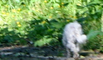
As we turned the corner, we saw this small white dog running down the road. I told Joe to stop and I got out to see if I could check it's tags. As I got close to the dog, it started to run. I chased the dog about 100 feet calling, "Puppy come here".I finally went back to the car, and had Joe turn around back toward the dog. I could see it didn't seem to have a collar. I told Joe, he needed to help me catch him. We found him/her going up the prison road. I got out again and tried to catch it. It turned around and ran down toward the Coast Drive we had just driven on. We turned around and headed toward the dog again. We both got out to corner it. I got close enough to almost grab it, but it turned it's head as if to bite me, so I pulled away as it slipped through my fingers. Then it headed back down the road toward Klamath . I tried one more time to catch it, but it headed into the woods. Our campground was located at the end of the road, so I asked our camp host if anyone in our campground lost a dog. The camp host said he had several people tell him about this dog. He said the Animal Rescue would not do anything about it unless you catch it. He said the dog was probably dropped off in the forest. When we got home I checked several websites that had listings of dogs that were lost. The only dog I found that kind of match the dog we chased, went missing from the Los Angelo's area a week prior. I  didn't think a dog could travel that far in one week. This dog weighted about 10 to 12 lbs. It looked like a Maltese or Poodle mix. I thought about this dog for 3 to 4 days wishing I could help it find it's way back home or find a new home. I worried about it being in eagle, bear, coyote, and cougar territory.
This lost small white dog was last seen on Klamath Beach Rd. in Klamath, CA.