


 |
| While at Timothy Lake North Campground, we decide to go to the Bushkill Falls, "The Niagara of Pennsylvania". This is their #1 attraction in this area. It had finally stopped raining and we needed some exercise. |
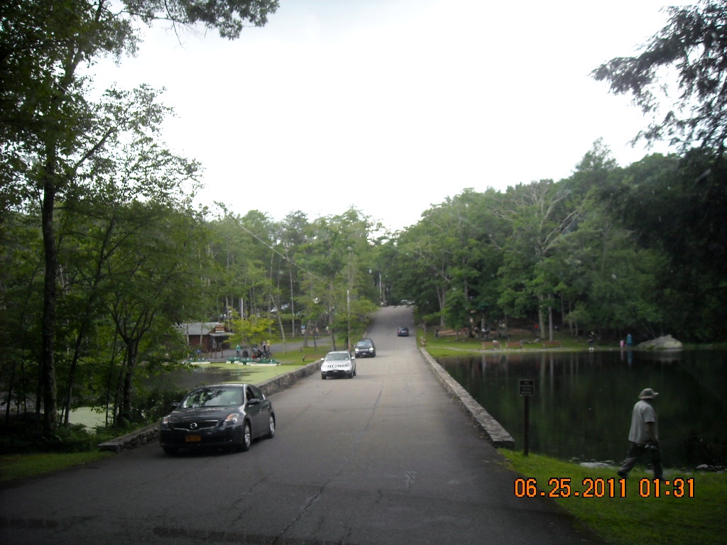 |
| As you enter the park there is a large pond. Many people were fishing or paddle boating around the pond. The park has a picnic area, miniature golf, souvenir and outdoor clothing stores. They also have a Snack Bar and Ice Cream Parlour. |
 |
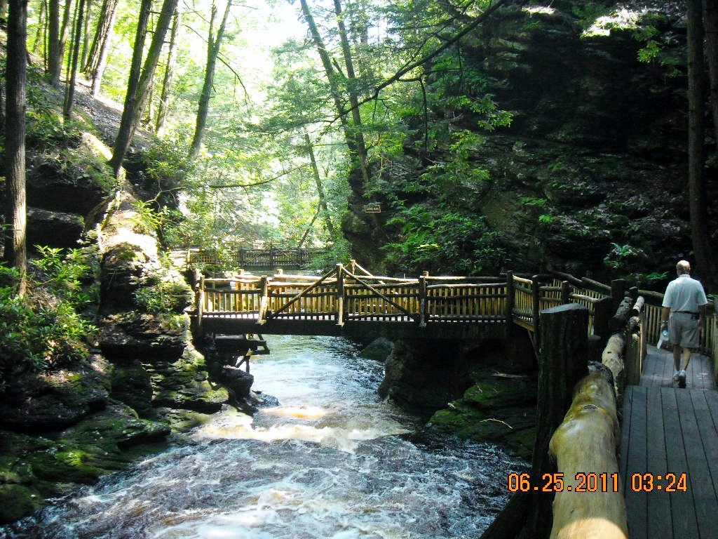
| At the falls you can choose from four different routes on foot. |
 |
| We choose route red, being the longest. The first part of the path is flat and even. |
 |
| Dogs are allowed on the path. Get a look at the lady walking her dog. She definitely did not come prepared. She won't be taking a very long hike with those high heeled sandals. |
 |
| These are the four color coded paths. The green trail has some steps and takes about 15 minutes. The yellow path take about 45 minutes and you see the Bushkill Falls from the top and bottom, as well as Lower Gorge Falls, Laurel Glen, and Upper Canyon. The blue trail takes you to Pennell Falls, and takes about 1 hour and 15 minutes. |
 |
| Charles E. Peters first opened Bushkill Falls to the public in 1904, with a single path and a swinging bridge over the head of the main falls. Bushkill Falls is still owned by the Peters family. |
 |
| This is a look from the top, before you descend down the stairs to the top of the Bushkill Falls. |
 |
| We were at the top of Bushkill Falls in this picture. We were here at the right time, with all the rain, the falls are flowing with force. |
 |
| This place has been maintain very well with the board walks though out. |
 |
| We got to # 13, Laurel Glen, and realized we were going the wrong way. |
 |
| We turned around and went back to the beginning. The maps are a bit confusing. They need to have different colored arrows painted on the board walks to make it clearer. |
 |
| We got to the main fall and headed down. |
 |
| Bushkill Falls drops 100 feet. |
 |
| Top of Lower Gorge Falls. |
 |
| Some places were still wet from dripping rock walls. |
 |
| And some places were muddy with puddles. Don't wear good shoes! |
 |
| Big Bushkill Creek to the Delaware River. |
 |
| My daughters seem to always beat me to where ever I go! |
 |
| Watch out for the big stump! |
 |
| We're hikers aren't we Joe? I don't know, it has been almost a year since we were out west. We might be a bit out of shape. |
 |
| Yes the path gets a bit rocky here. No high heels here, please! |
 |
| I was so glad there were a lot of hikers among us. We were in black bear woods again. |
 |
| Pond Run Creek |
 |
| # 8 Bridesmaids Falls |
 |
| That was a very long and steep climb up those stairs. It is a lot longer down than it looks. You can kind of see the stream down below, where the climb begins. |
 |
| # 9 Bridal Falls |
 |
| Another long climb up. I was looking down and taking a breather, again. |
 |
| At the top of Bridal Falls there is a look out spot up about 7 more stairs. |
 |
| A look down at some kissing lovers. |
 |
| #10 second Bridesmaid's Fall. |
 |
| This fall, you can get into the water and stand right in front of it. |
 |
| Another flight of stairs. I had stopped half way up to take another rest. This group of young girls and their mothers run up the stairs past us. I wished I still had that kind of energy! |
 |
| At the top of the last stairs we found a bench seat to rest at. Some people were going the wrong direction, like we started to do. I needed a dog to carry my water. We did not know dogs were allowed at Bushkill Falls. If we had brought Mallery, I would have been carrying her. |
 |
| We climb up some more stairs to another bench. I think we should have gone the other way, it might have been easier. I would have to say, Joe and I were the oldest on this part of the trail. We were so glad the sun was not out! |
 |
| Finally we reached the top, and found a forest of ferns. |
 |
| The red trail, then took us down a rocky path. Going down, my right knee was giving me a lot of pain. Maybe we did choose the right direction on the trail. |
 |
| We arrived at # 17 Pennell Falls. As I took this picture the guy kept looking at me. No I didn't want his picture! |

 |
| I believe this is Mountain Laurel, Pennsylvania's State flower. |
 |
| The water color is brackish looking, but clear. It was just hard to appreciate, after seeing the streams out west, last year. |
 |
| This mushroom looks like, rufous candy cap, but it said in my research the rufous candy cap is only located in California, Arizonia, and Mexico. Does anyone know what it is? It could also be a Russula emetica |
 |
| Mountain Laurel not opened yet. |
 |
| We reached Adam's Flats next to Little Bushkill Creek. |
 |
| This part would have been creepy, but there were other people in front and behind us. |
 |
| The sound of the running stream also had a calming effect. |
 |
| The signs on the tree are your guide. This is part of the red and blue trail. |
 |
| We got to the Upper Canyon. |
 |
| We had almost come full circle now. We got back to # 13 Laurel Glen, where we had gone before we realized we were going the wrong way. |
 |
| Back at the top of Bushkill Falls. The red trail takes you about 2 hours and 30 minutes. We did it in 2 hours. |
 |
| I walked across the bridge above Bushkill Falls on the west side to take a couple more pictures. The red trail does not take you to that side of the trail. View across the falls. |
 |
| This picture was taken in the same place as the previous picture, but looking down across to the other side of the canyon. These trails were worth the entrance fee of $11 each. If we ever come back, I would come. |
No comments:
Post a Comment