


Sunday 10/14/2012
 |
| We left Sheridan, Wyoming, and continued east on I -90. |
 |
| The NE corner of Wyoming is pretty much desert. |
 |
| Just a map of Sheridan before we continued east. You can see Sheridan is just across the border of Wyoming. |
 |
| We past Lake De Smet north of I-90. |
 |
| Our elevation was about 4,600 feet. |
 |
| Fall colors along the Powder River . We took whatever fall color we could get! |
 |
| Our black road turned into a red road. |
 |
| We saw several oil rigs along I-90 from Sheridan to Sundance. |
 |
| We stopped for lunch at the Flying J in Gillette, Wyoming. The Flying J was pretty much right off I-90. |
 |
| Just outside of Gillette we saw Buckskin Mine. This mine is one of the most productive coal mines in the USA. It produces more than 27 million tons of coal a year from the Southern Powder River Basin |
 |
| Our black road was going to turn red again. At this point in the drive we could see the Black Hills in the distance. |
 |
| The closer we got to the Black Hills, the more evergreens began to spring up. |
 |
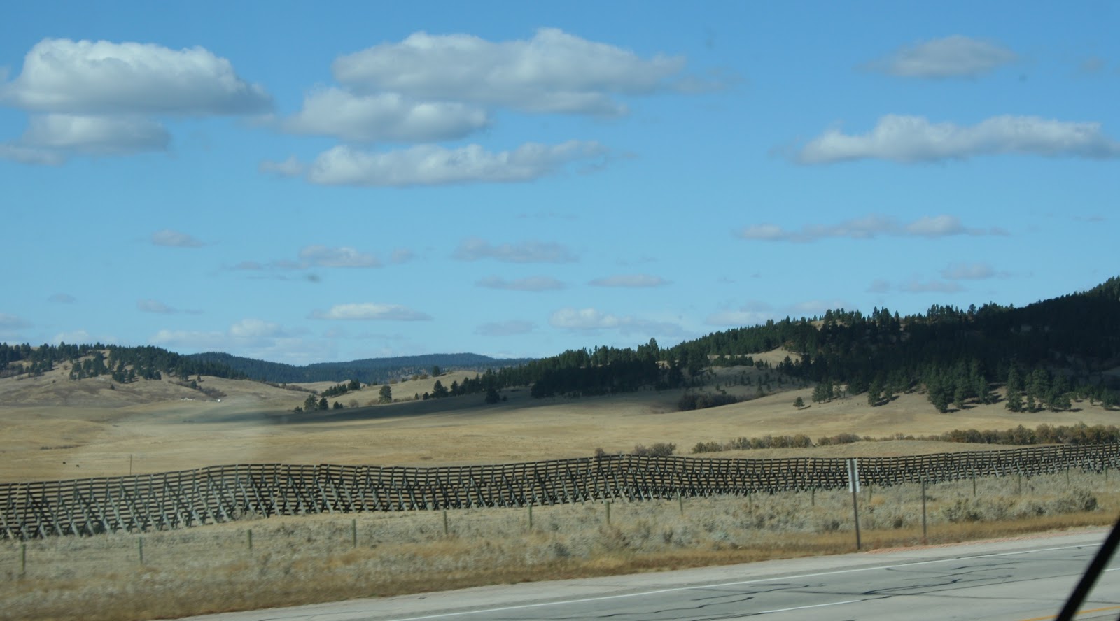 |
| We see these odd fence things again.They are not connected and do not keep things in or out. We had seen these, what looks like fences before, a couple of years ago during our travels, and wondered what they were for. We never got an explanation of them from any readers. I did a search on the internet and found out that they are just what we thought. They are snow fences that help stop blowing snow from winds and blizzards.. |
 |
 |
| We enter into the Black Hills Forest Recreation area. |
 |
| After a relatively short drive of 165 miles, we arrived at Mountain View RV Park in Sundance, Wyoming. |
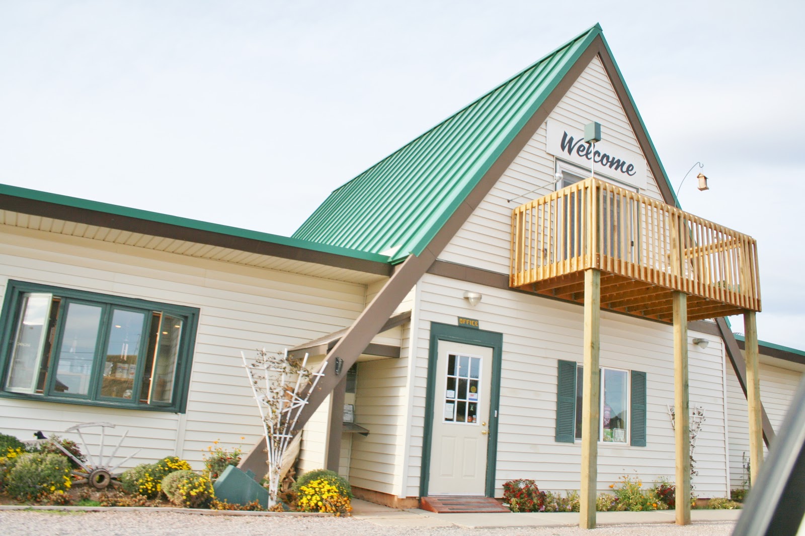 |
| The office and store, with laundry in the back of the building. |
 |
| The park sat at 4,700 feet. Here is a map of the campground. |
 |
| #'s 44 and up were shut down for the winter. We could chose sites 43 through 37. |
 |
| We chose site # 42. |
 |
| The upper sites are pull throughs. |
 |
| View from our upper site. |
 |
| Out front from the office were tent site areas and two cabins. |
 |
| View of the mountains from our Nest's front window. |
 |
| View looking to the left from our front window. We used our Passport America membership to stay in this campground for $17 a day. This campground is a very well maintain campground and we highly recommend it. We left Cedar Rapids, Ia today heading toward Gulf Shores, AL. We have an extra passenger with us on this trip. My mother June is riding with us and will stay at our girls house once we get there. She will stay until after Thanksgiving and then will take a airplane back to Iowa.. We arrived in Festus, Missouri tonight, which is just a few miles south of St. Louis, Missouri. |
No comments:
Post a Comment