


Tuesday 7/9/2013 |
| Every time we drove from Branson West to Branson, we went past this Resort Community. |
 |
| We decided to stop at it on the last day we were in the area, because it had nice views of Table Rock Lake, |
 |
| and the homes in the community looked strange from the road. |
 |
| All these homes after a closer look, looked abandon. We decided this community probably started in 2008 and then the crash hit, causing the company to go bankrupt. |
 |
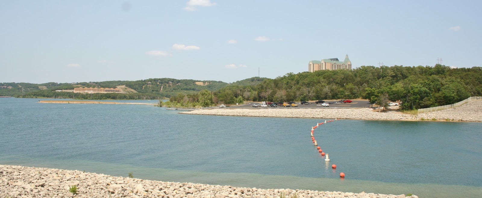
| Next we drove to the Indian Point Marina. |
 |
| Joe and I would like to be Blessed with a pontoon boat like this someday, when we find our lake view home. |
 |
| We were so impressed with the clarity of Table Rock Lake's water. |
 |
| A view from a Indian Point condominium complex. |
 |
| A view from Hwy. 265 of Table Rock Lake. |
 |
| We found a peninsula park area on the north side of the Table Rock Dam to get out and get more views. |
 |
| From the peninsula was a small dam. (This is not the main Table Rock Dam). Note the very blue water color. |
 |
| View of Chateau On The Lake Resort Hotel. |
 |
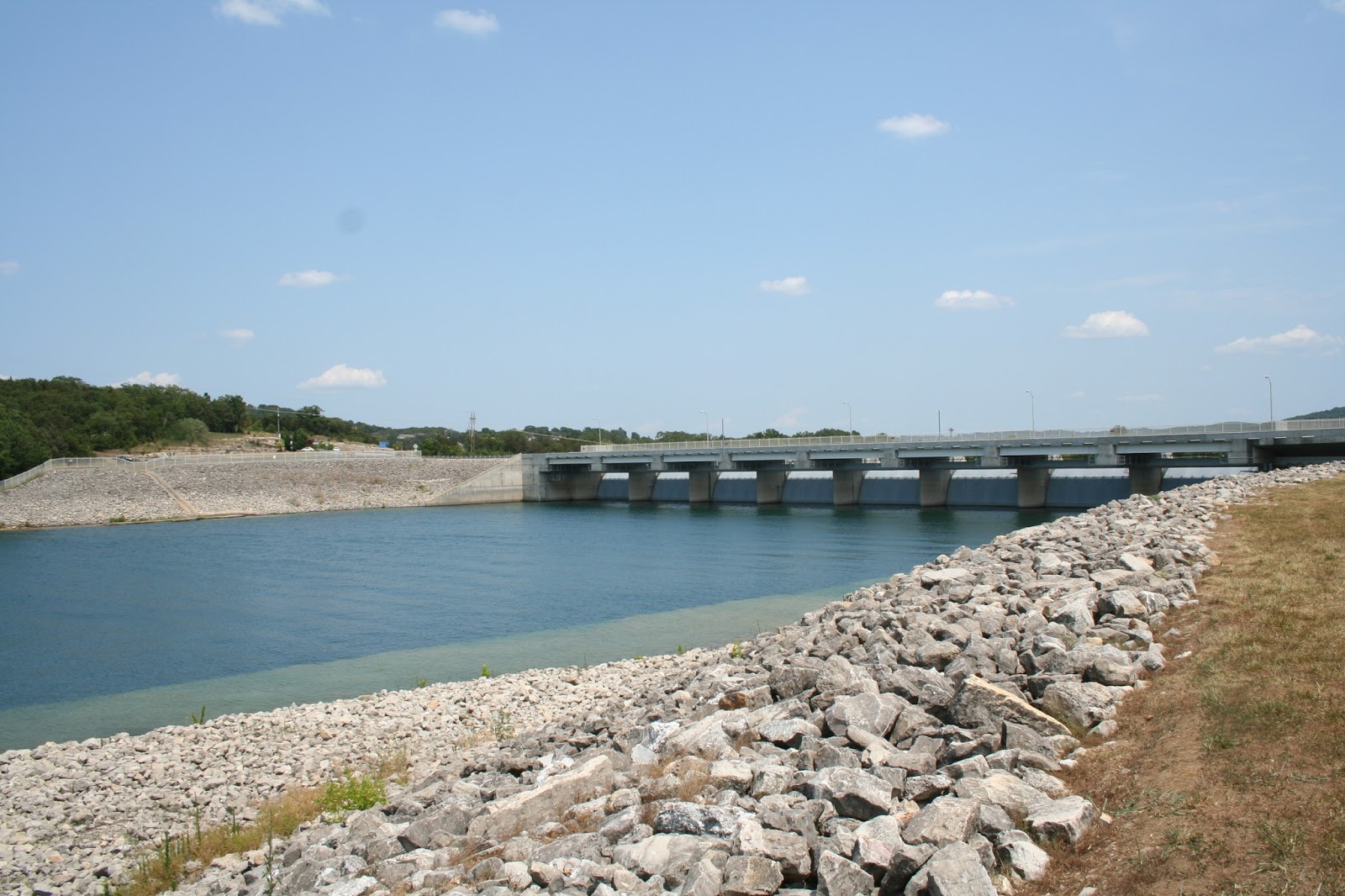
| We crossed the Table Rock Dam and found the Dewey Short Visitor Center. |
 |
| We had Mallery with us, so we took turns going inside. After I got back from inside, I met Joe in the back and took pictures while he went inside. The Table Rock Dam is 6,423 feet, and controls the White River. |
 |
| Table Rock Lake has a surface area of 43,100 acres. |
 |
| Inside the visitor center, I took some pictures of the lake and the dam location. |
 |
| This picture show the location of the town of Branson to Table Rock Lake. |
 |
| Lake Taneycomo flows from Table Rock Dam to the east. |
 |
| Table Rock Lake is in southwest Missouri, as well as in the northwest of Arkansas. East of Table Rock Lake is Bull Shoals Lake that lies on the border of Missouri and Arkansas. |
 |
| Further south of Bull Shoals Lake is Greers Ferry Lake, where we looked at some lake view properties. |
 |
| We left the visitor center and followed Hwy 165 to the Scenic Overlook. |
 |
| View of Taneycomo Lake toward the dam. |
 |
| View looking east up Taneycomo Lake. |
 |
| Close up of the previous picture, with Branson neighborhoods along the Taneycomo Lake. |
 |
| On our way home we stopped at the Branson View Campground. |
 |
| This campground had just reopened under new management and sits along Hwy. 265. |
 |
| The campground had three viewing pavilions along a bluff, |
 |
| with great views of Branson to the east. |
 |
| I am sure the night light views of the city were spectacular. |
 |
| I never showed a picture of Joe's meteorite that he purchase for $10 in Eureka Springs, AR.. I forgot to take picture of it until later after we left Arkansas. |
 |
| Not too many people can say they have a meteorite! |
 |
| On another note, our little Mallery will sit in front of her bowls and bark if I forget to feed her. Joe thought this was a cute picture, so he took this picture. We are still in Cedar Rapids, IA for another week. |
Joe's meteorite is pretty cool, how the hack did he even see that?
ReplyDeleteHi Paddle Partner, Joe bought it in a little shop!
DeleteLove the photos of one of our favorite places. Thank you for sharing them.
ReplyDelete