 |
| While camping at Two Medicine on the east side of Glacier, we took the very short hike to Running Eagle Falls. |
 |
| In late summer, the falls comes out from a underground cave. In the spring, water comes from above, from snow and rain run off. |
 |
| We then took Hwy 49 north, for 9 miles to Hwy 89. At Hwy 89, we drove 20 miles to St Mary's.Lake. area. |
 |
| We made a couple stops for picture time. |
 |
| The green looks like grass, but it is evergreens instead. |
 |
| It was a pretty drive in the Honda. |
 |
| Beautiful country. |
 |
| Right over the hill, |
 |
| you get the first glimpse of St. Mary Lake. |
 |
| Our first stop, was the Visitor Center. |
 |
| In the Visitor Center, they have a monitor of an Osprey on her nest. |
 |
| Right outside of the Visitor Center was the nest on a pole. |
 |
| We were about a week early before her babies would be hatched. |
 |
| The sign tells the size of St. Mary's Lake. |
 |
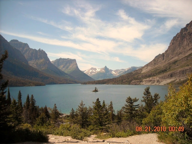
| St. Mary's Lake with a very small Island. |
 |
| A view of the Triple Divide Peak. The peaks of Glacier National Park stand as great American pyramids, each carved by wind, rain, and ice. Known as the “Crown of the Continent”, the park gives rise to northern most section of the Continental Divide in the United States, where glacial crests soar to heights over 10,000 feet. |
 |
| This was a very popular spot to take pictures. We waited and waited, and waited for our turn. |
 |
| I didn't like my picture, so Joe represents our visit to this spot. |
 |
| View of Island from different angle. |
 |
| We found Sun Point trail head for another hike. |
 |
| Sun Point |
 |
| A short hike along St. Mary's Lake to Baring Falls. |
 |
| Now off to Sunrift Gorge. |
 |
| Another short hike with some steep climbs to Sunrift Gorge. |
 |
| Formed when a small stream cut through a natural break in the rock. Sunrift Gorge is a straight steep canyon cut through the bedrock. If you do not want to hike to the gorge, it is 200 feet off " Going To The Sun Road", on the east side. |
 |
| Are these huckleberries? I would eat one, but not for sure. I should have bought the book on berry identification. |
 |
| A variation of a bee balm. We had bee balms in Iowa at our last home. |
 |
| Time to head back to Two Medicine Campground. |
 |
| One more stop to view St Mary's Lake. |
 |
| I love their, I think dandelions. They are so shiny compared to Iowa dandelions. |
 |
| Getting farther from St. Mary's Lake. |
 |
| Open range area, watch out for the cattle in the Blackfeet Reservation. |
 |
| Last view of St. Mary's Lake. |


No comments:
Post a Comment