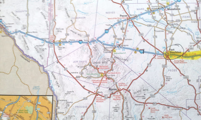
It was time to get on the road again, so we headed out of San Antonio,TX. We were held up about a half hour because during our checks, we found that the right turning signal on the car was out. We messed with it for a while, changing bulbs and things, but we couldn't fix it. It needed a replacement part, so we headed out anyway trying to be careful.
 |
| Must be a church off in the distance with the cross. I zoomed in.You could see it for many miles away. |
 |
| Our hills soon |
 |
| went down down down. |
 |
| to the Edwards Plateau. |
 |
| Then we had some more climbs... |
 |
| then downs again. The landscape turned to no trees, and just brush. |
 |
| After the small town of Ozona, TX. we started to climb even more... Nest 2 is going 55mph instead of 35mph up the steep hills, Yea! |
 |
| I think Joe even tried his exhaust brakes on one the descents. |
 |
| I-10 is 80mph once you leave San Antonio, Texas. |
 |
| We start to feel like we were back in the west again. |
 |
| It was chilly but a sunny day. |
February 16, 2012
 |
| The next morning we were, "On the road again".... |
 |
| It is very desolate west of Fort Stockton... |
 |
| but very beautiful ~ |
 |
| "Joe go to the right" |
 |
| This guy is very hardy. It was very windy and cold that day. |
 |
| I-10 takes you along the Mexico border near El Paso. |
 |
| Joe velcroed this basket to the dash because he needed a place for some of his stuff, but I think we will have to rethink this matter, because it is cluttering up my pictures. |
 |
| We stopped at this rest stop for lunch. It looked so warm and sunny, but I had to put on a winter coat because the wind was chilling to the bone. |
 |
| Mallery hates doggy rest area's. They must be just too smelly like our out house's. |
 |
| El Paso seems to sit with mountains all around it. |
 |
| It is the 6th largest city in Texas and 19th largest city in the United States. |
 |
| There was some writing on the side of a mountain wall, but I could not read it. It was probably in Mexican anyway, so if I could have read it, I still would have not been able to read it.. |
 |
| El Paso sits at 3800 ft. above sea level. |
 |
| We continue north... |
 |
| and reach 4579.1 ft. elevation, |
 |
| and a few miles further... |
 |
| we enter into New Mexico. |
 |
| New Mexico Land Of Enchantment. |
 |
| This truck stop was also a large truck stop, but this one had a lot of pull in spots. |
February 17,2012
 |
| We start our 3rd and final all day road trip. |
 |
| It starts to rain... |
 |
| but we were glad, because we didn't have to worry about dust storms. |
 |
| We saw several signs that said zero visibility is possible during dust storms on this section of I-10. |
 |
| With all day drizzles |
 |
| we finally enter into Arizona. |
 |
| Snow capped mountains. |
 |
| Joe pointed out "The Think", and said he had seen a ton of signs for it. Here is what I found: Roadside attraction hyped by signs along Interstate 10 between El Paso Texas, and Tucson, Arizona. Teaser ads, such as The Thing? What is it? and Mystery of the Desert, entice travelers along this sparse stretch of desert highway to stop, just to find out what the mysterious Thing? might be. It is a: a mummified mother-and-child tableau encased in a glass-covered coffin. Glad we didn't stop. |
 |
| We start up again... |
 |
| and reach 5006 ft for the highest elevation for the last 3 days of driving. |
 |
| This section off I-10 had many neat rock formations |
 |
| and the rain stopped. |
 |
| We have enjoyed the last two days of driving. |
 |
| I love to see landscape that man has not touched. |
 |
| Benson, AZ. is down in the valley below. We stopped at the Benson Super Wal-Mart for groceries, before we drove 8 more miles south to St. David, AZ. |
 |
| St. David, AZ. ~ Establishes 1877 ~ Population 1744 ~ Elevation - 3690 ft. |
 |
| Ah, so glad we are home. The three long day drive was tiring and we both were ready for a weeks stay in one spot. Our day drive was 239 miles, the shortest of all the 3 days. |


No comments:
Post a Comment