


Thursday 4/19/2012
 |
We left Hume Lake and drove back 3 miles to Hwy. 180 in Sequoia National Forest. At Hwy. 180 we drove east toward Cedar Groves. |
 |
 |
The road became scary to me, as I looked down the side of the mountain. |
 |
You never know what you are getting yourself into until you do the drive! Then it is too late, because there are no places to turn around on such curvy roads. |
 |
The road are sheer drop offs, curvy, |
 |
and a constant downhill drive. You can't help but wonder what would happen if your brakes gave out! |
 |
See that red building down below? That's where we are going. |
 |
 |
I had my foot on the my brake on the riders side, the whole time we were going down the mountain. |
 |
Funny how that seems to make me feel better! |
 |
Like I've mention in the past, I take lots of pictures to keep myself preoccupied when we are on a downward scary ride. |
 |
I don't understand how Joe can drive these roads with his fear of heights. |
 |
I don't know why they do not have railings on these roads! |
 |
Finally some brick walls! |
 |
I think this was one of the scariest drives to date! |
 |
We finally reach flat ground for a while. |
 |
This is the Kings Canyon Lodge, but it was not open that day. It is open mid May to Mid October. When it is open, there is gas, food, lodging, and ice cream to be had. |
 |
Just down from the lodge the road is closed. We knew the road was closed half way down and would not be able to go on the Kings Canyon Scenic Byway or go to the end of the road in the valley. The road is closed due to falling rock in the spring and is re-opened mid- April. We were there mid April, but it was still closed. Maybe because of the last late snow storm that had come in 2 weeks prior. |
 |
I took a couple of pictures at the end of the road for us that day, before we turned around. |
 |
 |
We turned around and headed back up the mountain. I captured the road we are headed for while Joe was driving |
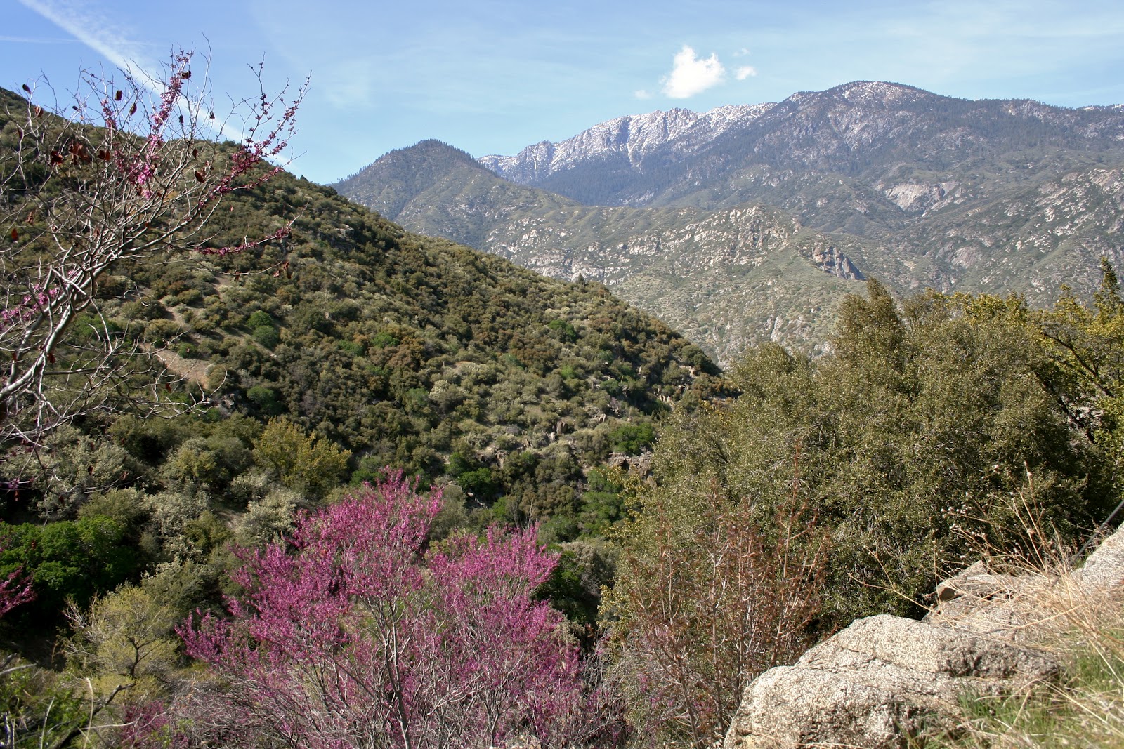
The colors in the mountains are really pretty. |

 |
We stopped at Vista Point on the way back up. |
 |
It is a magnificent view! |
 |
A close up. Pictures just don't do it justice. |
Looking back down at the road we were just on. |

 |
Close up of previous picture also. |
 |
The snow capped mountain out in the distance is Mt. Harrington at 11,008 ft. Just one of the highest peaks in the Sierra Nevada Range. The highest mountain, Mt. Whitney at 14,494 ft., is beyond the Continental Divide on the eastern slope of the Sierra Nevada. It is the highest mountain in the contiguous 48 states. The highest point, Mt. Whitney and the lowest point, Death Valley, in the USA, are only a few hundred miles apart. |
 |
On the way back we stopped at a few more stops that we didn't on our way down. We were back on the west slopes of the Sierra Nevada's where the smog is. |
 |
The best time to come to the Sequoia's & Kings Canyon National Park is in the summer, when all the roads are open. |
 |
We missed out on Mineral King, another national park south of Sequoia, because the roads were still closed. |
 |
There was also other roads and trails that we were unable to see because of the snow. |
 |
The one thing good about coming when we did, is that it was not as crowded as it is in summer. |
 |
The mountains are lined with bushes with these flower buds. |
 |
Anyone know what kind of bush they are? |
 |
We celebrated Mallery's 11th Birthday yesterday on May 2. In dog years that makes her 77 years old. She is much older than us now. |
 |
 |
It was a long day of driving, and it would have been much better, if we had stayed in the park, |
 |
but after driving to the park, we don't think we would have enjoyed driving the Nest on the curvy roads, besides the extra cost of gas. |
 |
Back down to the green foothills of the valley and closer to Blackstone RV Park in Fresno. |
No comments:
Post a Comment