


Sunday 5/13/2012
 |
| We decided to investigate the west side of Lake Tahoe first while in the area. We are in a forest of pines, but in this one spot on the south west portion of the lake, we saw this patch of Aspen trees. |
 |
| We had planned on leaving the Lake Tahoe area at the end of our 9 day stay by way of Hwy 89, or the west side of the lake. After driving this route for the day drive, we changed our mind. |
 |
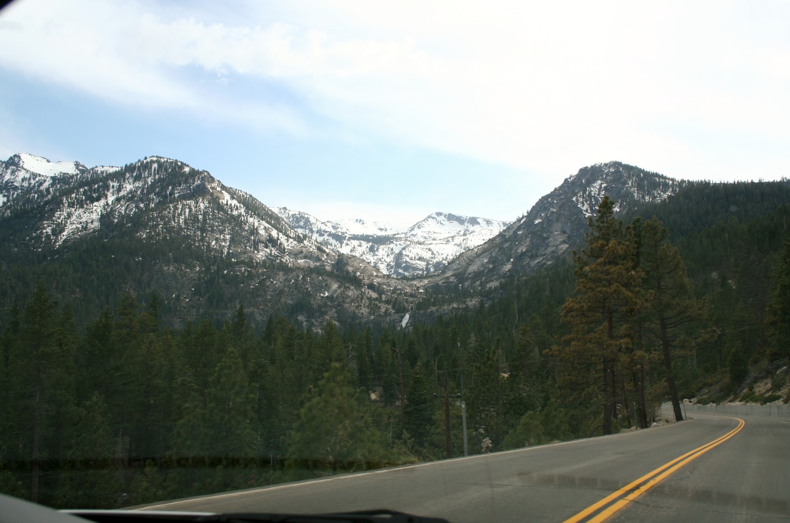
| View of the southern border of Lake Tahoe. This route had a couple very tight curves, and a sign saying RV longer than 30 ft or double axial not advised. |
 |
| This was a short section of the drive, Joe and I didn't care for. |
 |
| On one side, it dropped straight down with no guard rails. The other side drops off too with no guard rails. |
 |
| View of the ferry tour boat, as we cross the narrow road, high in the sky. |
 |
| Our first stop was at Inspiration Point Vista. |
 |
 |
| From this vista, we get our first views of Emerald Bay. |
 |
| Close up view of lake beyond the bay. |
 |
| View of Vikingsholm Castle on Emerald Bay shore. |
 |
| I switched out to our new zoom lens to get this close up of the castle. |
 |
| Lots of boats in the bay to see the castle. |
 |
| Looking across the bay, you can see the road in the mountain, that continues around the lake. |
 |
| Looking out past the Emerald Bay's peninsula, and the northern peninsula of the bay. |
 |
| View of Fannette Island, the only island on Lake Tahoe. |
 |
| Tea House on Fannette Island. I will tell you more about the tea house later. |
 |
| Southern peninsula of Emerald Bay. |
 |
| We left Inspiration Point Vista, and continued north. |
 |
| We pass the source of Eagle Falls, and Eagle Falls, because Joe didn't see the pullouts. We will catch the falls another day. |
 |
| As we drive around Emerald Bay, I snapped a picture of the entire bay. |
 |
| Next stop: parking lot to Vickingsholm Castle. |
 |
| Looking back across to the other side of the bay where Inspiration Point Vista is. You can also see the road coming around the bay. You also can see the landslide on the right that occurred many years ago when a contractor used too much dynamite in a road widening project. |
 |
| From the parking lot we can zoom in to see Eagle Falls. We read that there was a mile walked down to the castle, then a mile back up.Because someone sleeps in until 9AM, and then takes two hour before leaving the house, we had a late start that day. We decided the castle would be another day's adventure. |
 |
| We headed back home, and drove back across the high in the sky road bridge. |
 |
| This is another scary part of the drive, when going up. Going down, you are on the inside, so it if fine. |
 |
| The curve coming up is one of the tricky spots on the west route of the lake for longer RV's. |
 |
| A 10 mile curve ahead. |
 |
| We go past the Aspen Tree grove again, |
 |
| and make a stop at Baldwin Beach. |
 |
| It cost $10 per car to enter into the beach, but we asked if we could just drive through. The ranger gave us 10 minutes to get back. Looking north on Baldwin Beach. |
 |
| Looking south on Baldwin Beach. |
 |
| View as we were leaving Baldwin Beach Park. |

thanks for sharing as we will be in the Lake Tahoe area in about a week or so...
ReplyDeleteIt is just gorgeous! One of my most favorite places to date.
Delete