


Tuesday 6/4/2012
 |
| It was time to see the Pacific Coast, so we took the Hwy. outside of Duncans Mills toward the ocean. |
 |
| Duncans Mills Camping Club is just about 4 miles east of the coast. |
 |
| Just before we got to the coast, we went through the town of Jenner, CA. |
 |
| The homes sit on the hill facing the south on the mouth of the Russian River, where the river enters the ocean. |
 |
| Jenner has a population of 136 people. Check out the gas prices. |
 |
| Russian River making it's way to the Pacific Ocean. |
 |
| Russian River entering the Pacific Ocean. |
 |
| Joe and I thought these were dead fish, but a local we asked later about it said, "were they the sea lions that are out there all the time"? I zoomed the picture in, and found they were not dead fish put sea lions like the local suggested. |

 |
| We headed north up the Sonoma Coastline. |
 |
 |
| On top of a hill we stopped for a picture looking south. |
 |
| RVs longer than 30 ft. are not recommend on Hwy. 1. |
 |
From Jenner, CA. the coastline is State Beach land for 4 miles to the north. |
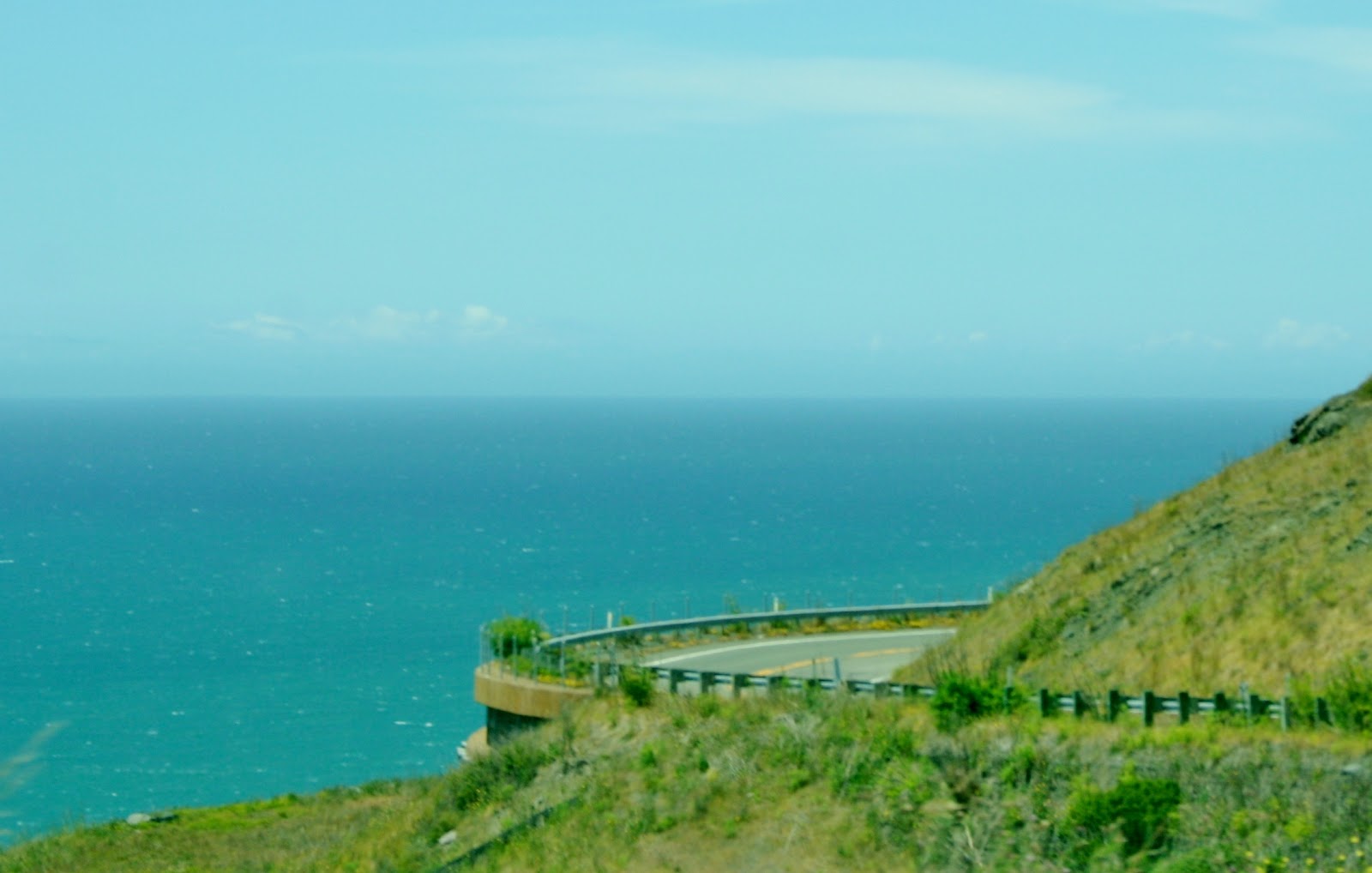 |
| View of the highway as it swings out toward the ocean. |
 |
| As you can see it is a curvy road that follows the cliff side. |
 |
| We continue to follow the coastline with gorgeous views of the ocean as the road goes up then down then round and round. |
 |
| There are a lot of cattle ranches along this stretch. |
 |
| We came around a curve and there was this little piece of land with an RV park, perched right above the ocean. |
 |
| This Mobile Home/ RV Park is in the Timber Cove area. From my research, the lots are owned by each site occupant. |
 |
| Just down the road is the Timber Cove Inn. |
 |
| Further down the road, there are camping sites at Salt Point State Park. The Woodside Campground is across the road from the ocean, and has 79 sites. On the ocean side there are 35 sites in the Gerstle Cove Campground in Salt Point State Park. I thinks the sites are for 31 ft RV and less or tent sites. We didn't drive in, but from looking online, it looked to be for shorter RVs. |
 |
 |
| When we drove through this group of trees, we got a very, very, very, strong aroma. We found out later from asking around that these group of trees were eucalyptus trees. |
 |
| Some of the coastline had a few farms or ranches. |
 |
| At this point we come across a housing development along the ocean. The houses all look similar, especially in color. This community has strict restrictions to preserve the natural beauty of the area. |
 |
| The community is called Sea Ranch. |
 |
| The community has a lodge with a restaurant, gift shop, post office, and pool. |
 |
| Sea Ranch Lodge |
 |
| View from Sea Ranch Lodge. The community is north of the lodge. The community encompasses 10 miles of the coastline. |
 |
| From Jenner to the end of Sea Ranch, it was 27 miles, but it took longer to drive because of the curvy road. |
 |
 |
 |
| This was another campground we found on the way and back along the coast. They had sites for 40 ft RVs. Not sure how the 40 ft. RVs get there, but there was one in the campground. |
 |
| The temperature was about 68 degrees that day with full sun, but still chilly with the strong ocean breeze. |
 |
| There were a couple of different looking homes along the way. |
 |
 |
| Back to the curvy roads, |
 |
| with the ocean below! |
 |
 |
 |
| "What are those things by the road"? |
 |
| "Oh they are cows"? |
 |
| How often do you see cows with a ocean view! |
 |
 |
| A look back at the road on the mountain wall. |
 |
 |
| Hwy. 1 below from Hwy. 1 above. |
 |
| This guy is pretty big for the curves. |
 |
| A great view! Picture shows how the road drops and curves along the coast. |
 |
| A great example of the northern California coastline. |
 |
| We got back to Jenner, CA. and headed home. |
Beautiful pictures and yucky gas prices!!!
ReplyDeleteYes, Joe doesn't like the gas prices at all!
Delete