


Wednesday 6/12/2013
 |
| The first full day in Hot Springs we went to the downtown area to find the Visitor Center. We didn't see it but our GPS said it was 700 feet away so we parked and started to walk. Two blocks away we found it. That darn Ran McNally GPS! We wish we had never bought it. Our previous Garmin GPS was so much better! |
 |
| After listening to a short film at the Hot Springs National Parks Visitor Center, we walked down the street to the Hot Springs city Visitor Center. In the parking lot of the city visitor center we found one of the sites of the hot springs water fountains. After getting more information we went back 3 blocks to get our car and then drove back to get some free water back in the parking lot. The water is 147 degrees F. when it comes up from the hot springs. No time for fun on this first day, because we needed to get grocery's for the week. |
 |
| The next day we went back downtown to the National Park. Hot Springs downtown area sits in the middle of the National Park. |
 |
| We drove into the park going straight up to Hot Springs Mountain Tower. The cost to go to the top cost $6 a person. If you are smart, you would have gone through your brochure that you got at the visitor center and had cut out the $1 off per person coupon. Joe found it after we left the tower. You can walk to the top or take an elevator. Because it was 98 degrees out we took the elevator, not to mention Joe hates heights, so the elevator made it easier for him. The tower rises up to 216 feet. |
 |
| Hot Springs Mountain has an elevation of 1040 feet. At the top of the tower, there is a museum and an enclosed 360 degree viewing room. You can take the elevator or stairs to the top open air viewing area. I took the stairs from the enclosed floor to the open air viewing balcony for the following pictures. Here is a picture of Hot Springs, AR. below. |
 |
| I continued to take these pictures turning left. |
 |
| And now a bit further to the left. |
 |
| Looking northwest toward the Ouachita Mountains. |
 |
| We finished the one way road back down Hot Springs Mountain, then drove through a neighborhood toward West Mountain on the other side of the downtown. This was one of the neat old homes along the way. |
 |
| Then we entered West Mountain and started the climb. |
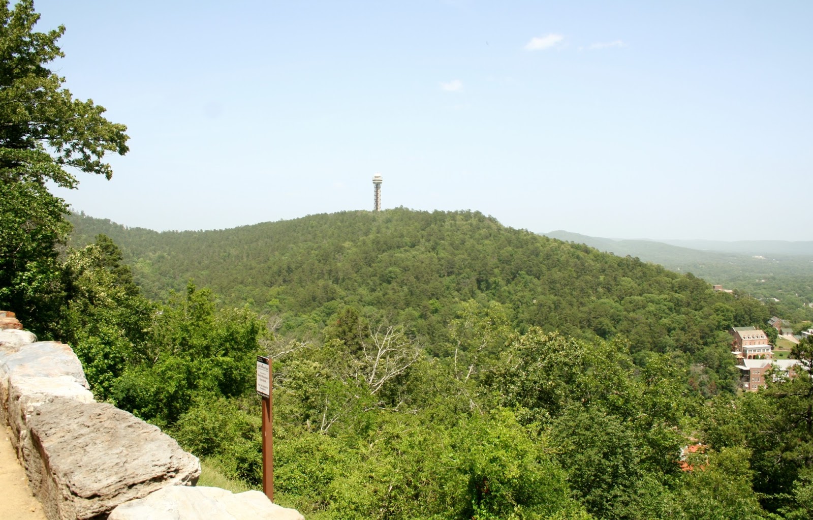 |
| Half way up we made a stop to get another view of the town area and the tower where we had just left. |
 |
| The view at the top of West Mountain was not as good as Hot Springs Mountain. |
 |
| There is a trail head of the Sunset Trail at the top of West Mountain. |
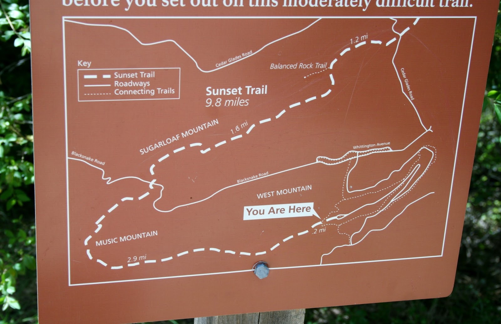 |
| This trail is 9.8 miles. This trail is not for us even on a cool day. There are many trails we would have liked to have done for exercise, but it is just too hot for trails this week. Joe and I do not do well in hot weather. |
 |
| On the way home we drove down Hwy 7 to see Lake Hamilton. Lake Hamilton was created in 1932 with the Carpenter Dam holding back the Ouachita River. The lake is 7,460 acres, and located on the southern edge of Hot Springs. |
 |
| The Ouachita River flows into the lake from the west. The water from this view point was not very clean. |
 |
| We headed back across the Hwy 7 bridge which divided the lake. If you continue east, the Ouachita River flows into Lake Catherine further down river. |
No comments:
Post a Comment