


Sunday 8/18/2013
 |
| This Munising Front Range Light was located right on Hwy. 28 as we were headed toward downtown Munising from the west. There is also a Munising Rear Range Light a few blocks south of this light. Both the front and rear light replaced the Grand Island East Channel Light in 1905. The Light is managed by the National Parks Service at this time. The grounds are open to the public, but the tower is closed. Mariners use both the lights to know if they are to the left or right or in line of the ranges. |
 |
| We spent the day driving to see a lakefront property on 16 Mile Lake, and on the way home we stopped at the Wagner Falls. It is located off Hwy 94, just southeast of Munising. |
 |
| The trail to the falls is very short, probably less than 1/4 of a mile. |
 |
| It is a pretty nice fall and worth the short walk in. |
 |
| When we got home, I wanted to go to our beach in the RV park and collect a few Lake Superior rocks. When I first got into the water, it was cold, but in a very short time, it felt refreshing because it was a hot day. Mallery likes to be with me, so she ran into the water up to her tummy before she headed back to the shoreline. |
 |
| Then because she was so cold she ran up and down the beach and got all sandy. |
 |
| Before we went back to the Nest, I had to dip her in deeper water to get all the sand off of her. Joe had to go to the Nest to get a towel before I dipped her because I knew she would be cold. If we had sewer hook up at our site, I could have just given her a bath back home. We only had electric and water for the four nights, and our grey tank was getting close to full. This is a picture before I dipped her up to her mid back. She shook all the way back to the Nest in her towel! Poor baby. |
 |
| The next day we had made reservations to go to Grand Island. The ferry is located at Powell Point, about a 1/4 mile from our campground, Tourist Park Campground. We went back and forth trying to decided whether to take the bus tour for $22 each (which included the ferry ride), or to rent some bikes once we got over to the island. Because it was forecasted to be a hot day, we decided to take the bus tour, and forgo the exercise. |
 |
| We signed up for the 11:00 ferry ride and the 12:00 bus tour on the island. |
 |
| The ferry ride over to the Grand Island takes maybe 3 minutes max. |
 |
| There are Black bears on the island. I guess they, as well as deer, swim back and forth to the island at night. |
 |
| Once over on the island we had to wait an hour for our bus tour. There was a visitor center with lots of exhibits about the island's history. This is a picture of the shape of Grand Island with legs. |
 |
| The Trout Bay was used from 1905 to 1956 to bring guests, and supplies to the Island. |
 |
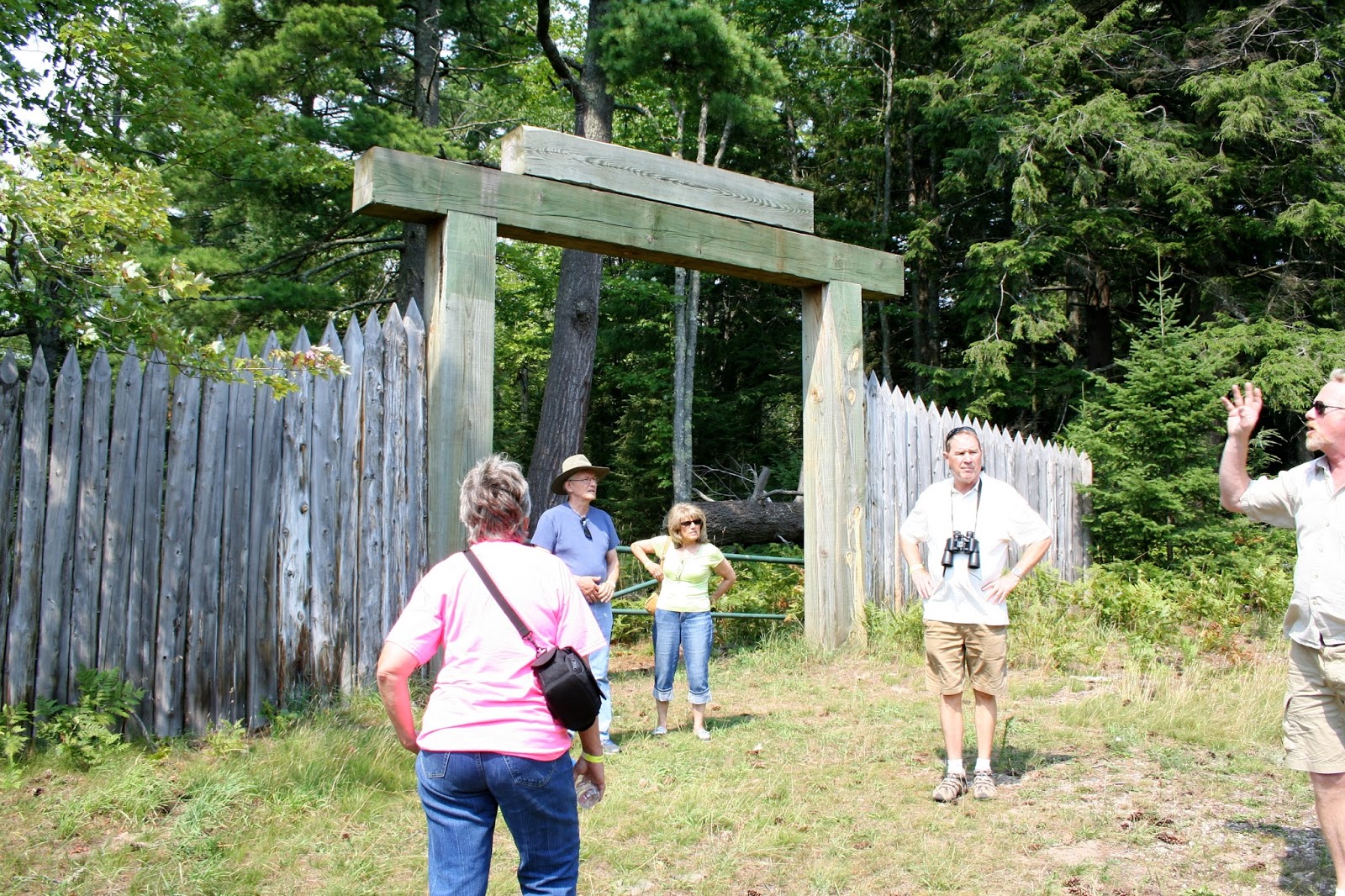
| Once on the bus tour we and 4 other couples were driven to beaches, present day private cottages, and a few park owned cottages. The Ojibwa or Chippewa Indians first used the island for a summer home. In the early 1800's, fur trappers built small cabins along side the Chippewa who were very friendly. Abraham Williams was one of the first Europeans to settle on the island. One of Williams descendants married a Powell, so there were Williams and Powell's on the island. We visited a cemetery that had only Williams and Powell family members buried in it. Joe and I didn't stay long in the cemetery because the mosquitoes were biting. If you visit Grand Island don't forget your insect repellent. |
 |
| This was a stop at one of the beaches. |
 |
| I believe this is Trout Bay. |
 |
| It had very calm waters for swimming. |
 |
Our tour then took us to the west side of Grand Island to Mather Lodge. William Mather & Cleveland Cliff Iron Company purchased the island in 1900, except for the few private owned cottages. Mather built a resort for many of the wealthy businessmen from his company and friends. |
| It was much more breezy on this side of the island. |
 |
| Mather used this as his main resident as well as his hunting lodge. |
 |
| He built a wild exotic game preserve on much of the northern island for hunting/ and the protein served in the resort. The US Forest Service purchased this property in 2012 making it available for viewing to the public. If you are hiking or biking, you will not get to tour the inside of the Mather Lodge. Viewing it is only for those on the bus tour. |
 |
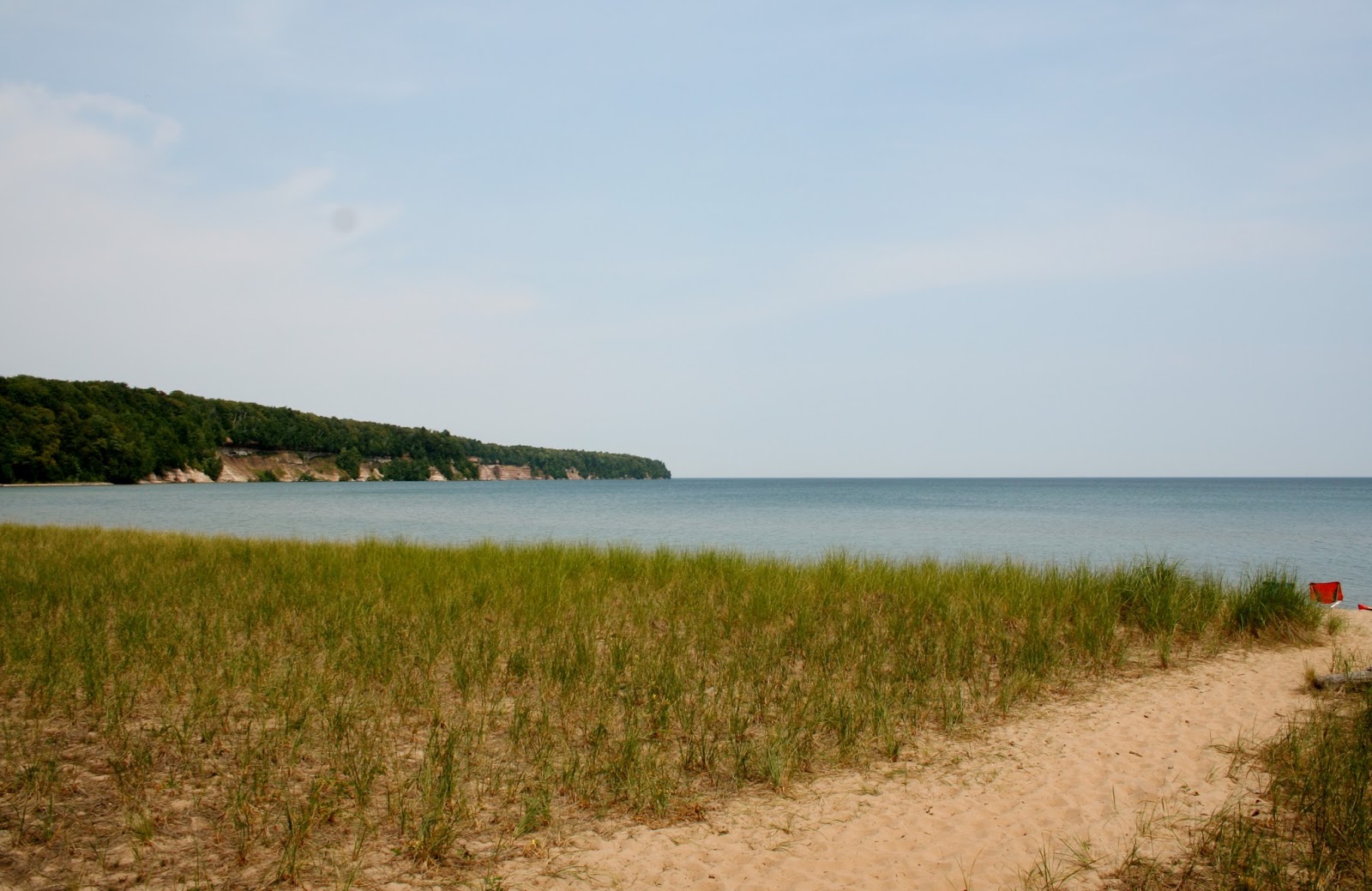
| Our last stop was at Waterfalls Beach Overlook. We were given about 30 minutes on the beach or walk a nearby trail. We went to the beach and I waded in the water and collected a few rocks. |
 |
| Then we went to the trail for the last 15 minutes. The trail runs along the west shoreline. |
 |
| Along the trail we came upon an area with mounds of green moss. |
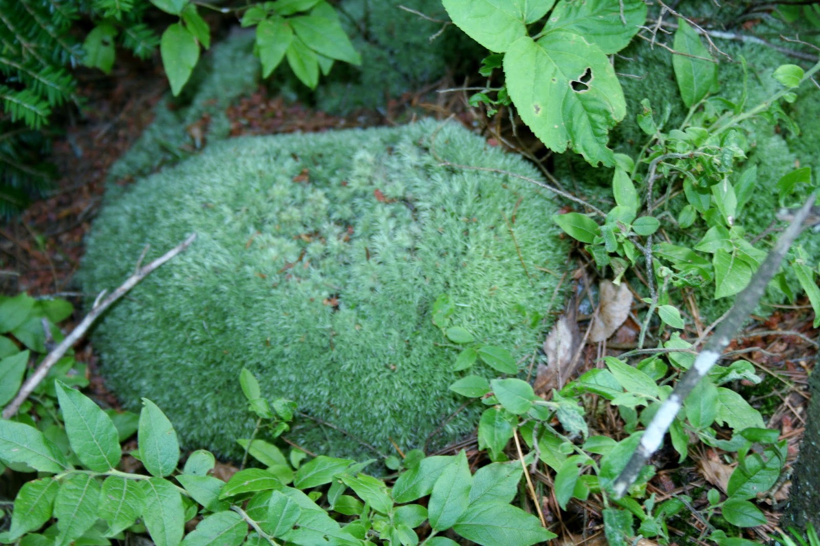 |
| Many of the mounds of moss were the size of a basketball. |
 |
| There were a mixture of different mushrooms along the trail also. It was a beautiful trail but the mosquitoes were attacking me like crazy. |
 |
| After our 3 hour tour, we took the ferry back to the mainland. I took this last picture of what once was Abraham Williams home, and during the "Resort Era", it was part of the hotel. When the US Forest Service purchased the island, the private cottage owners were allowed to stay. One cottage on the island has been past down for 7 generations. Our tour guide was very good with a wealth of history and information. The island is very rugged with no food or water available, so be sure to bring what you need. We were both glad we took the bus, because the mosquitoes were bad and it would have been much too hot that day. If you want to hike or bike the trails, I suggest waiting for fall when the color is better and the mosquitoes have died off. To bike around the whole island, signs say it is 21 miles and plan on 6 hours of biking. There are a couple of shorter routes, one a 12 mile which takes 3-6 hours, and a 8 mile that takes 2-4 hours. |
No comments:
Post a Comment