


Monday 9/16/2013
 |
| We left the Lake Michigan Overlook in the Sleeping Dunes National Lakeshore, and drove to the Dunes Climb of the National Park. |
 |
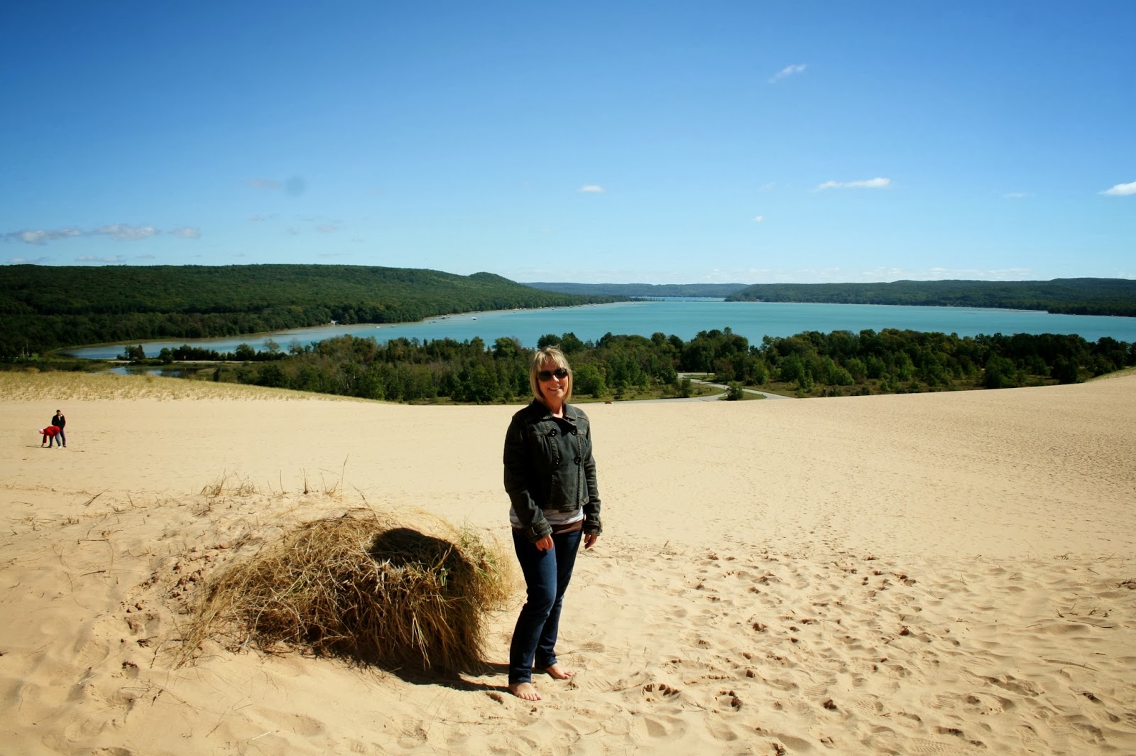
| The climb is 110 feet high. |
 |
| It didn't take us long to climb it. It was a piece of cake compared to the sand dune we climbed in Oregon. Once at the top, you got this view of Little Glen Lake with Big Glen Lake off in the distance. |
 |
| Close up of previous picture. |
 |
| View of a farm over the hill from on top of the sand dune. |
 |
| Then we climbed to yet another higher level, before we turned around. If you want more exercise, you can climb up further. |
 |
| We walked back down to the first top level, and Joe went on down the hill, while I took a picture of the north shore of Little Glen Lake. The north shore ridge of Little Glen Lake is called Alligator Hill. Do you see the long snout on the north east end. |
 |
| Joe took a picture of me way at the top. |
 |
| So much easier coming down. |
 |
| We left Dune Climb of Sleeping Bear National Park to yet another area of the park. |
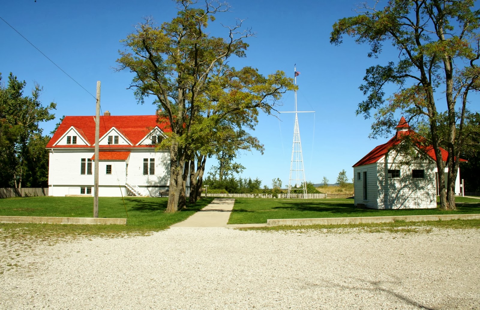 |
| The Sleeping Bear Point Coast Guard Station Museum is located further north in Glen Haven, MI. The main building of the Coast Guard Station hold a museum and short film of the life saving services done in this area years ago. |
 |
| The upstairs of the main building had a completely restored sleeping quarters of the Coast Guard men who served here. |
 |
| Joe found a room that had a replica of a lake going ship of that era. |
 |
| In the museum, I found another picture of the "Breeches Buoy" used during the rescues. Often the surfmen had to be hauled out to a wreck to help the people off. In the summer, rescue demonstrations are given of drills and equipment used to fire a rescue line from the shore. |
 |
| We walked out to the lake shore just a few steps from the Coast Guard Museum. Even though Lake Michigan is not an ocean, you still have to be careful of rip tides. |
 |
| To the north of this area we look into the Sleeping Bear Bay, and toward Glen Arbor. |
 |
| Out from this point we can also see South Manitou and it's 1871 lighthouse. |
 |
| Glen Haven is a historic town of the turn of the 20th century. This was the general store. |
 |
| The town was established in 1857, and by 1881 there were 11 buildings in the town. The village had a cherry cannery, and a saw mill, an Inn, to name a few. |
 |
| Sleeping Bear Inn was established in 1860 and was known for it's pancake breakfasts, whitefish dinners, and it's clean spartan rooms. The park services purchased the entire village by the mid 1970's. |
 |
| Just up the road is the town of Glen Arbor. There are many shops, restaurants, motels, canoe, kayak, and bike rentals in the town. You can canoe on the Crystal River to Lake Michigan. Crystal River starts at Glen Lake and flows through Glen Arbor to Lake Michigan. We basically just drove through town due to time constraints. |
 |
| We continued up M-22, |
 |
| to Port Oneida, or at least that was what we were trying to find. We came to a parking lot with stairs to the Michigan Lake. |
 |
| At the bottom of the stairs we found a beach. The point ahead is Pyramid Point. There are a lot of trails in this part of the park, if you want to hike. If you are looking for a private beach, this would qualify for that search. |
 |
| On the way back up the stairs I found this locust just minding it's own business, but said it would love to pose for a picture. |
 |
| We headed back down M-22 and made a stop to see Glen Arbor Beach in Sleeping Bear Bay. |
 |
| The Coast Guard and Maritime Museum is on the south end of this bay. |
 |
| Our last stop before going home was Inspiration Point in the park. This point is located off of Hwy. 616 on the south shore of Big Glen Lake. |
 |
| An eagle flew by as I was taking pictures. |
 |
| A view looking east toward Little Glen Lake, and the channel that separates the lakes. |
 |
| Close up of the bridge and channel between Little Glen Lake and Big Glen Lake, with M-22 crossing between the lake. |
 |
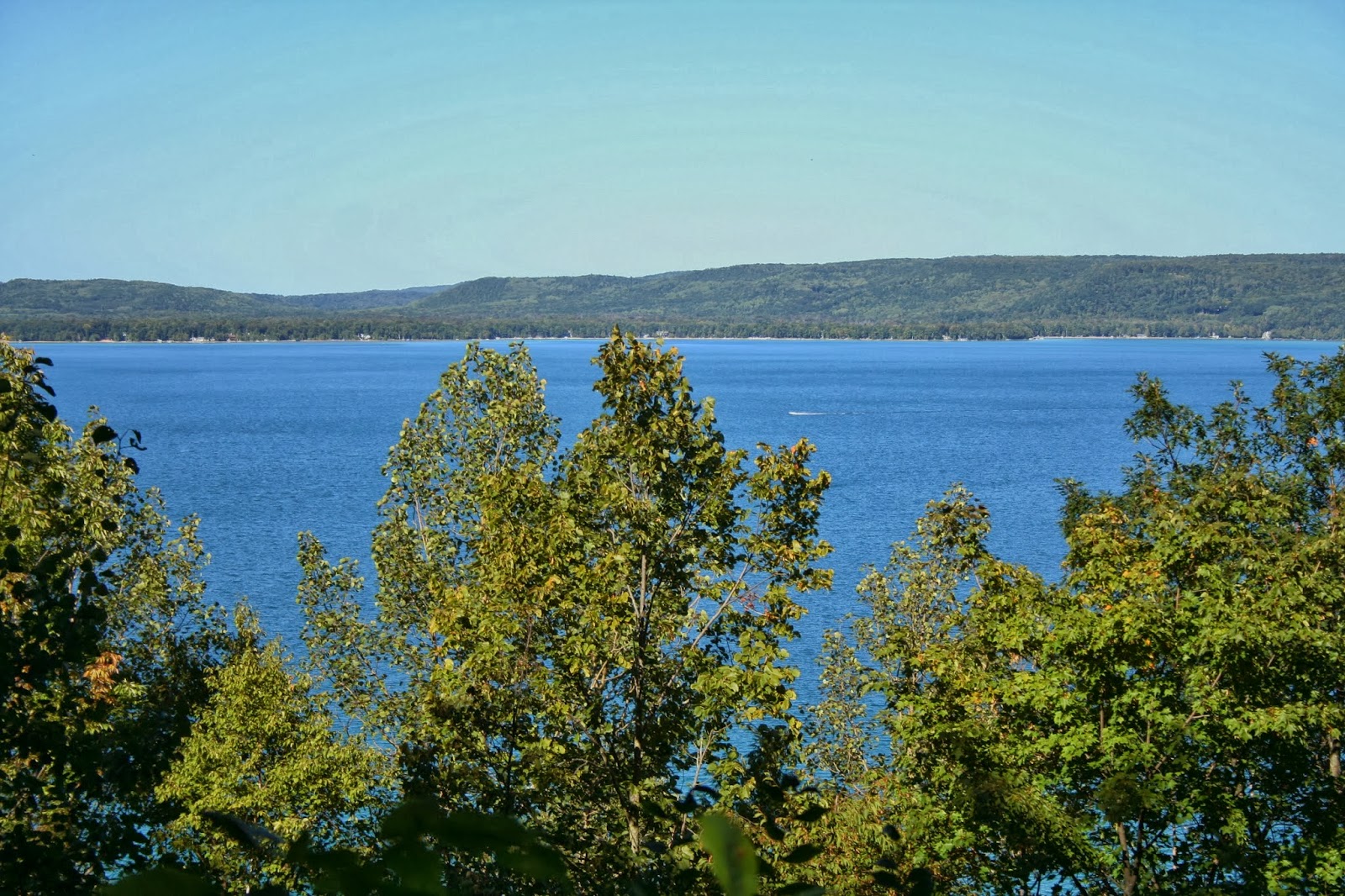
| We could see Big Glen Lake, Lake Michigan and South Manitou Island from this point also. |
 |
| Close up of the three. |
 |
| This is a close up of the north shore of Big Glen Lake. |
 |
| According to local legend, Glen Lake was recognized as one of the most beautiful lakes in the world by National Geographic Magazine. Although the National Geographic Society denies ever publishing such a ranking, the assertion dates back to at least 1936. |
 |
| This shot of the north shore of Big Glen Lake shows the start of the color change in the area. I could take one of those homes on the hill above the lake. Below is a picture of Glen Lake that I found on the internet. You can see North and South Manitou Islands, and Sleeping Bear Bay also. We arrived in the very small town of Heiskell, TN. yesterday. Heiskell is so small, we couldn't find it on our maps. It is 12 miles NW of Knoxville, TN. We plan on staying here for 8 days. |
No comments:
Post a Comment