


Tuesday 10/8/013
 |
| While in Vonore, TN., we heard about the Cherohala Skyway, and it just so happened to be the highway we were going to travel to see another lake. |
 |
| We took Hwy. 360 from our campground to Hwy. 165. Hwy 360 was 19 miles to Hwy. 165, but because it is so curvy, it was a much longer drive than we thought it would be. Hwy. 165 is also called the Cherohala Skyway. This dragon was on Hwy. 165 because most people do The Dragon (Hwy 129) and the Cherohala Skyway (Hwy 165) as a loop drive. Also most people get up early and allow plenty of time to do the loop drive (unlike us) or stay in a motel in Robbinsville, NC, as a midpoint stop. (Sorry the picture is blurred, but if I had Joe stop for all my pictures, we would never get to our destinations until after dark). |
 |
| The Cherohala Skyway follows the Tellico River for the first part of the drive. This covered bridge is a private owner's bridge to his home. |
 |
| Not too many people can claim they have their own covered bridge to their home. |
 |
| Along the way, we saw another Harley-Davidson store with this sign calling the Charohala Skyway, "The 100 Million Dollar Highway". The highway was started in 1958 and completed in 1996 at a final cost of 100 million dollars. |
 |
| Don't you just love all these photo shots from the car with me in the side view mirror. I try my best to get up high enough to get past the mirror, but most the time it doesn't happen. One of the disadvantages of being short! |
 |
| Our first overlook and pit stop at a smelly out house. |
 |
| A view looking west. I could see a home out amongst the Cherokee National Forest. |
 |
| With the zoom lens I got even closer to the lonely home in the forest. |
 |
| With the zoom lens, I was able to located and capture another home way off in another direction. Can you image living that far from a neighbor? I bit too far for me in bear country! |
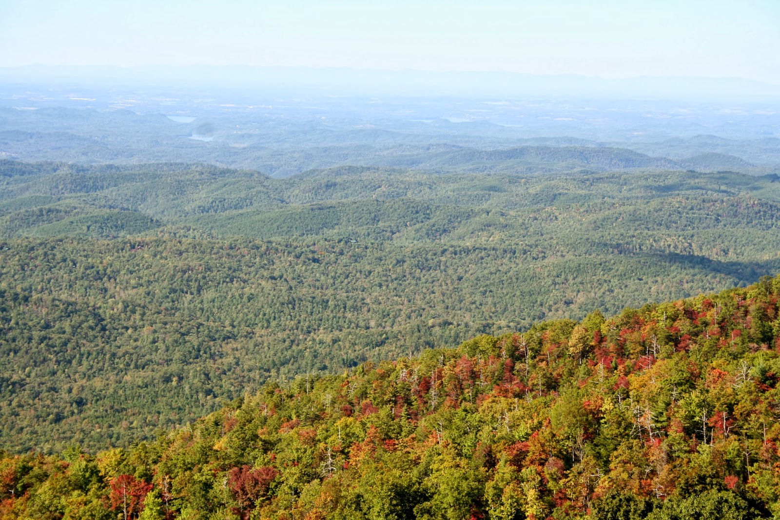 |
| Further up the road we made another stop at the Lake View overlook. Can you see the lakes? |
 |
| With the zoom lens I got a better picture of the lakes. I believe one of those lakes is Tellico Lake where we were staying. |
 |
| The Cherohala Skyway is a very enjoyable drive with guard rails throughout. I would not hesitate to do this drive again. |
 |
| At almost all the turnouts we saw locals with their hounds hunting for black bear. Joe asked one hunter some questions and he told Joe that the up coming Friday was the last day of the bear hunting season. |
 |
| From this view you would think we were at the top, but we had a ways to go. If you have time, there are many trail heads along the drive. |
 |
| We left the Cherokee National Forest and arrived into the Nantahala National Forest. Now I know where the Cherohala Skyway name came from. |
 |
| Shortly thereafter we cross over the state border into North Carolina for the second time in two days. Hwy. 165 changes to Hwy. 143 once you get into North Carolina. |
 |
| There were several 9 1/2 % down grades on the drive, which were fine for the car, but a little steep for the Nest. Would not really want to do this drive in our rig, but for some people it would be no problem. |
 |
| We continued to climb, and tree color became more impressive. |
 |
| At another pull out there were some gawkers checking out a side car, with me included. I sure would not feel comfortable is the low riding side car. |
 |
| We finally get to the top, |
 |
| at 5377 feet. |
 |
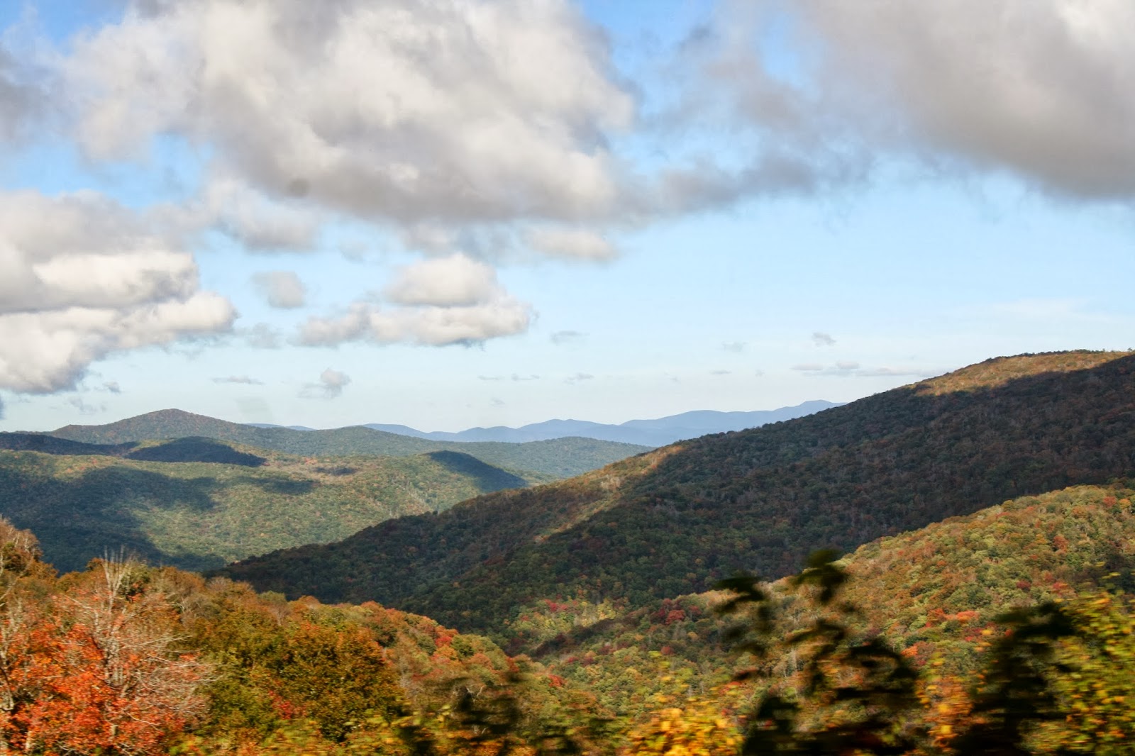
| We enjoyed the fall color while at the top, |
 |
| because it did not last long, once we went down several hundred feet. |
 |
| We were really too early for the peak color of natures fall show. |
 |
| Just one of the many pull out stops for a look see or picnic lunch. |
 |
| I still got to enjoy the layers of mountain tops that you get anytime of the year. |
 |
| We finally arrived to Robbinsville and gassed up for our continuation of the drive. The total miles from Tellico Pains to Robbinsville is 43 miles. (North Carolina must not be a self service state, because the gas station pumped our gas for us. It makes you feel like the old days gone by)! |
 |
| In Robbinsville we took Hwy 129 to Lake Santeetlah. We were starving, so we pulled off at a boat launch area of the lake to eat our lunch. |
 |
| After lunch we drove to the Cheoah Point Beach to see if we could get better views of the lake. |
 |
| The beach was closed due to the government shut down, so we walked in instead. |
 |
| We found we were not getting a much better view of the lake from this beach either. |
 |
| Here is a picture on our GPS of the Lake Santeetlah. It is like most of the reservoir lakes in the area, lots of long thin fingers of the lake. The little blue dot shows where we were at the moment on the lake via the next pictures. |
 |
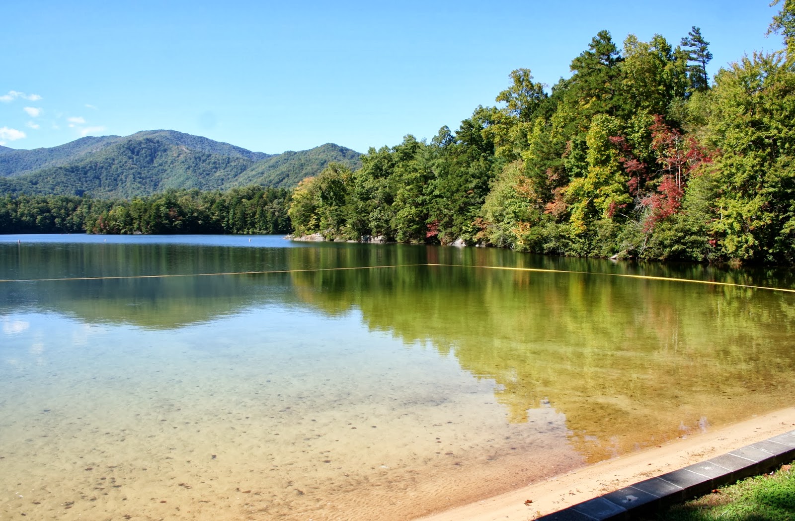
| We stopped at the marina, and got probably the best open view of the lake there. |
 |
Lake Santeetlah has 76 miles of shoreline and is formed by the damming of the Cheoah River. The lake is part of the Tennessee River watershed. |
 |
| A pretty view as we continued our drive along the north shoreline of the lake. The lake is below in the small openings between the evergreens. |
 |
| From Lake Santeetlah it was 10 miles to the Cherohala Skyway and 51 miles to Tellico Plains, TN. |
 |
| View of a stream as we traveled on Hwy. 143 along the eastern side of Lake Santeetlah, to Cherohala Skyway. |
 |
| The drive went much faster going back because we only made a couple stops. Most of the really good shots of color had to be taken while driving because no pullout were available. |
 |
| Going back, at the top, we were up in the clouds. |
 |
| We wondered when we were going to Lake Santeetlah what these tall posts were. We saw about 2 to 3 of them at the top. Further down the road we found out from a roadside exhibit, they were put up for flying squirrels to use to cross the highway. |
 |
| We wondered if we were going to get caught in some showers going back. |
 |
 |
| but once we started to go back down from the top, the clouds separated and let the sun shine through again. |
 |
| Once again we enter back into Tennessee, and Hwy. 143 changes to Hwy 165. |
 |
| We make the lake view stop again, hoping it would be better, but it was about the same. When we arrived in Tellico Plains, we decided to forgo Hwy. 360 to get back to our campground. Instead we took Hwy. 68 to Madisonville, then Hwy. 411 to Vonore. The drive to Hwy. 411 and Vonore was faster because Hwy. 411 was straight, and not full of curves like Hwy. 360. |
 |
| Our total drive for the day was 162 miles. |
No comments:
Post a Comment