


Saturday 5/10/2014
 |
| We left Hartland, MI. the next day and drove 73miles to Bay City, MI. I am pointing to where Bay City is located in Michigan, at the bottom of the thumb and first finger. We have found Michiganders describe their location according to a hand. |
 |
| We stayed at another Wal-Mart because we were a day ahead of our schedule and didn't have reservations until Sunday. Yes we could have called the park and moved our reservations up one day, but then we would have paid full price. We were using our Passport America membership, and the 1/2 price for that campground was only good for stays between Sunday through Thursday, and that is not the LaFontaine way! |
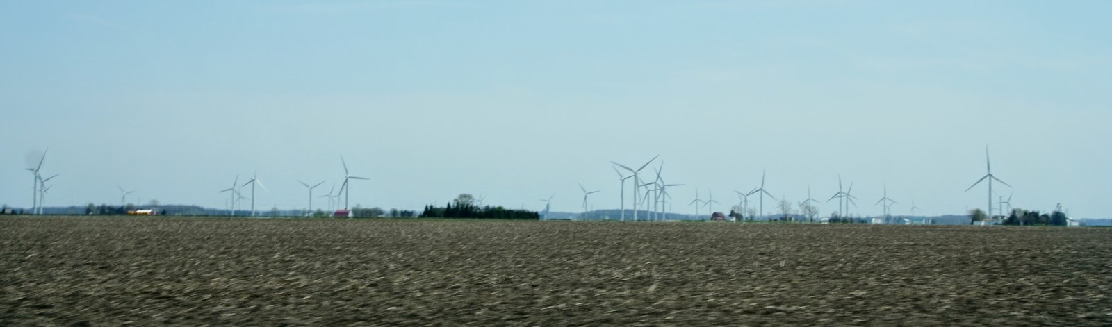 |
| After setting up, we unhooked the car and took a day drive up toward the tip of the thumb. The first 40 miles was inland, flat, and boring. I was driving, so Joe took pictures. We saw lots of windmills on the farmland of this area. |
 |
| In Bay Port the road finally started to follow the water. This was a public access stop where there were a couple people fishing in Lake Huron. |
 |
| Bay Port was once known as one of the world's largest fresh water commercial fishing ports. |
 |
| As we passed through the town of Bay Port, Joe snapped this picture of the Bay Theatre. |
 |
| About 10 miles further on Hwy. 25 we stopped at the Sleepers State Park. |
 |
| We found a boardwalk to the lake. |
 |
| While I was walking the boardwalk, Joe was taking pictures of a informational exhibit. This map shows Bay City and Sleeper State Park. (The first Christmas Tree going east up the thumb). This map also shows the east coast of Michigan. We will be traveling up the east side of Michigan to Alpena, then traveling across Michigan to Petoskey. (The town of Petoskey is on the map, but not labeled). |
 |
| A few people on the beach even though it was a bit cool that day. |
 |
| I cringed when I watched this kid walk into the water. I heard him say it was excruciating. I bet, it wasn't too long ago that all the Great Lakes were frozen over. |
 |
| Joe asked if I had seen the sign about muck. What the heck is muck? And where did it come from? |
 |
| No dogs are allowed on the beach. Don't worry, we just walked Mallery on the boardwalk to get a view of the lake. Sleeper State Park also has a campground, but it wasn't opened for the season yet. |
 |
| Our drive to Port Austin was another 26 miles NE up the thumb. But at least it was along the lake shore, so it was more enjoyable. |
 |
| View of the port in Port Austin. |
 |
| We drove up the downtown area. This is an old bank turned into a restaurant in Port Austin. |
 |
| Next we found a sign pointing to the beach. We found a boardwalk along the beach. |
 |
| Another view of the port. Out in the port we could see people walking out to a point. |
 |
| View of the beach from one of the covered picnic gazebos on the boardwalk. We were looking for the lighthouse that was suppose to be in Port Austin. |
 |
| Not able to find the lighthouse we were going to head back, and found a street with a sign saying Scenic Street. This is where the jetty was that people were walking out to the point of the port in Port Austin. |
 |
| View looking west along Lake Huron shoreline. Because of the lateness of the day, we just took pictures and didn't walk out to the point, and headed home. |
 | |||
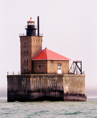
| I found out latter, that you have to take a boat ride to see the lighthouse. The picture above is of some of the fields we saw on our drive home. The picture below is of the Port Austin Reef Lighthouse. |
 |
| All in all, the long 135 mile drive was not really worth it, but at least we know what the area looks like. |
No comments:
Post a Comment