


Wednesday 6/20/2012
 |
| On our second day in Gold Beach, OR. we took a day drive up Hwy.101 along the coast. |
 |
| Our first stop was at Battle Rock in Wayfinding Point. |
 |
| The community was named after a battle between Capt. William Tichenor, a white settler, with nine men and the local Tututni Indians. |
 |
| The Capt. and the nine white men were held up on the Island until they escaped nrth during the night. |
 |
| Note the two people climbing up a trail on the Island. We walked down to the island, but the trail up was very steep, and coming down would not be easy. Later I found a sign that asked that people not climb up the trail on the island. |
 |
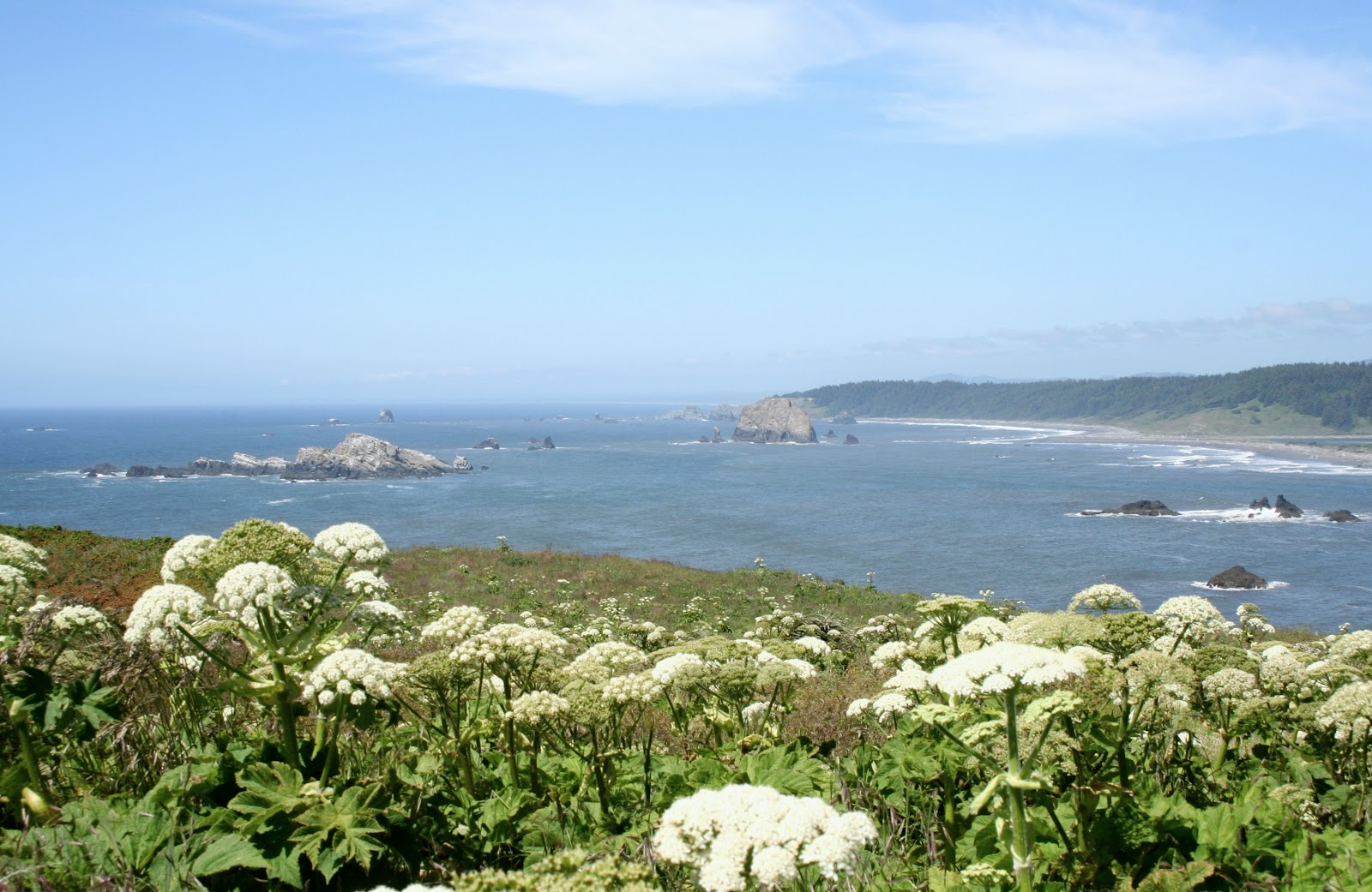
| View down the coast from Battle Rock at the sea stacks. |
 |
| A bench down by the water to enjoy the views. |
 |
| There was a visitor center, restrooms and lots of information about the southern coastal towns, at Battle Rock Wayfinding Point. |
 |
| The next town we stopped at was Port Orford. Port Orford is the most westerly city on the Oregon Coast. |
 |
| We first stopped into the Port of Port Orford. |
 |
| There is a seafood restaurant in the port. |
 |
| Joe and I have never seen a truck hauling a boat like this before! |
 |
| There were a ton of birds in the harbor at Port Orford. |
 |
| Above the harbor we found a overlook. |
 |
| The Port Orford Overlook had a beautiful mosaic wall with local scenes on it. |
 |
| View from Port Orford Overlook. |
 |
| Artist Cheryl Morse created the beautiful mosaic wall. |
 |
| We continued up Hwy. 101 for 5 miles to the entrance of Cape Blanco State Park. Cape Blanco State Park has a campground as well as cabins and Yurts. The cabin and Yurts are pet friendly for an extra $10 per night. |
 |
| As we drove into the park, we saw a sign for the Patrick Hughes House. |
 |
| The house is a EastLake-style Victorian home built in 1898. |
 |
| The Patrick Hughes family established a dairy farm near the cape in 1860. They lived on the land in another house for nearly thirty years before they could afford to build their dream home. |
 |
| Local residence volunteer to provide viewing of the home to the public. |
 |
| The Patrick Hughes homes is open to the public for free, but a donation is welcome to maintain and restore the home. While in the home, we met volunteer Inge Licon. She is a very nice local who owns Inge's Studio 2 in Langlois, Or. which is a small community just north of Cape Blanco. Some how I got to telling her that I needed a hair cut, and she recommend a hair stylist to me. ( Another inconvenience to being a full time RVer - trying to find hair stylist, chiropractors, and doctors on the road. My hair was down to my shoulders and I like to get it off my neck for the summer). |
 |
| After seeing the Patrick Hughes home, we continued up the road for the lighthouse. Note the lighthouse days and hours they are open. We fortunately got there just before they closed. |
 |
| Views north from top of the cape. |
 |
 |
| Cape Blanco Lighthouse 1870 |
 |
| Cape Blanco Lighthouse is the state's oldest active lighthouse |
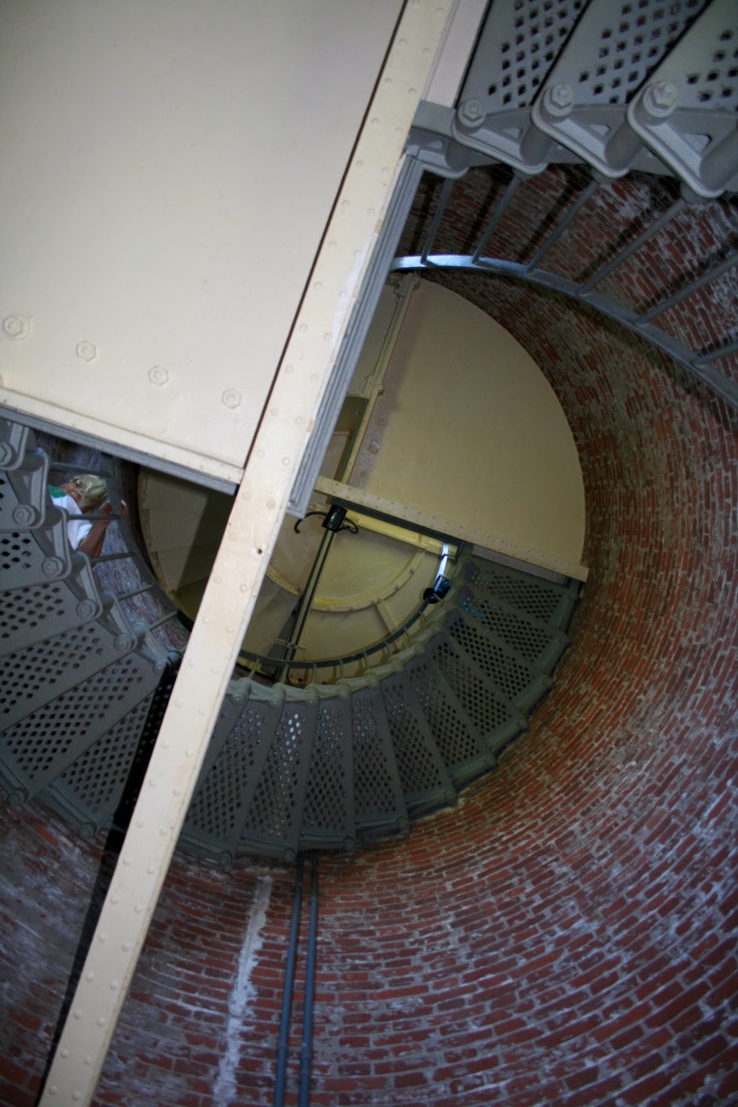 |
| We took a tour of the lighthouse using our annual National Parks card that we purchase earlier this year. The cards has paid for it's self, with savings to boot! |
 |
| Cape Blanco was first outfitted with a first-order Fresnel lens in 1870. A second-order Fresnel lens was replaced in 1936. It was a chilly day, but when we were standing next to the lens while the volunteer was telling about the lighthouse, it got really hot, fast, from the sun reflecting off the lens. I was glad it was chilly that day! |
 |
| View looking south while at the top of the lighthouse. The lighthouse keeper's living quarters use to be located below, about where the garages are now. |
 |
| The light keepers and their families had to grow and raise their own food on this windy bluff, because there were no grocery stores back in the 1870's |
 |
| Views north in the lighthouse. |
 |
| We were told winds reach a maximum of 160 miles per house at the cape. |
 |
| After getting back to our car, we drove to the top of the cape to the south for this view. |
 |
| Views on our drive back to Gold Beach. |
 |
 |
| On the way home we stopped at the Prehistoric Gardens in Oregon's rain forest. Our grandson Noah would just love this place. |
 |
| This area receives 80-100 inches of annual rain, so the garden has all kinds of rain forest plants. I believe the cost was like $10 a person. The garden has many more life size dinosaurs inside. We decided to save this visit for another day when we have are grandson along. |
 |
| Outside the gardens I found this ground squirrel eating some bird seed as we went back to our car. |
 |
| More views as we drove back down Hwy. 101 for home. |
 |
 |
| Before we cross the Rogue River, we took this picture of the town of Gold Beach, OR., where we were currently staying . |
 |
| This picture shows the Rogue River entering the Pacific. Oceanside RV Park, where we were staying is locate on the south side of the Rogue River on the other side of the jetty. |
 |
| Can you see Nest 2 behind the pavilion's blue roof in Oceanside RV Park. |
 |
| This is the Isaac Lee Paterson Bridge, known as the Rogue River Bridge - built in 1931- It is one of the most notable bridges in the Pacific Northwest. It has a Art Deco design. |
 |
| Views of the Rogue River Bridge as we cross to get to Gold Beach and home. |
Beautiful photos of my favorite area. Thank you for sharing!
ReplyDelete