


Tuesday 6/26/2012
 |
| We continued from Bastendorff Beach County Park on Cape Arago Hwy.and headed south along the coast. The next stop was Sunset Bay State Park. The beach is in a bay, so it is great for swimming. There is a campground at Sunset Bay State Park also. |
 |
| Further south we came to Shores Acres. |
 |
| At Shores Acres there is a botanical garden that features a rose garden and a Japanese garden. We didn't stop to see the gardens because the day was waning. There is also a gift shop at Shore Acres, but it was closed by the time we got there. |
 |
| Looking south at Shore Acres. |
 |
| Looking north at Shore Acres. |
 |
| We could hear sea lions from there, but couldn't see any. We searched the shore, but they were nowhere to be seen. I ran into a couple who was coming back up a trail. They told us there were some seals and sea lions further south. They told us we could take the trail from Shore Acres or drive further south on Cape Arago Hwy. to them. |
 |
| We drove down to Simpson Reef because as I said before, it was getting late. |
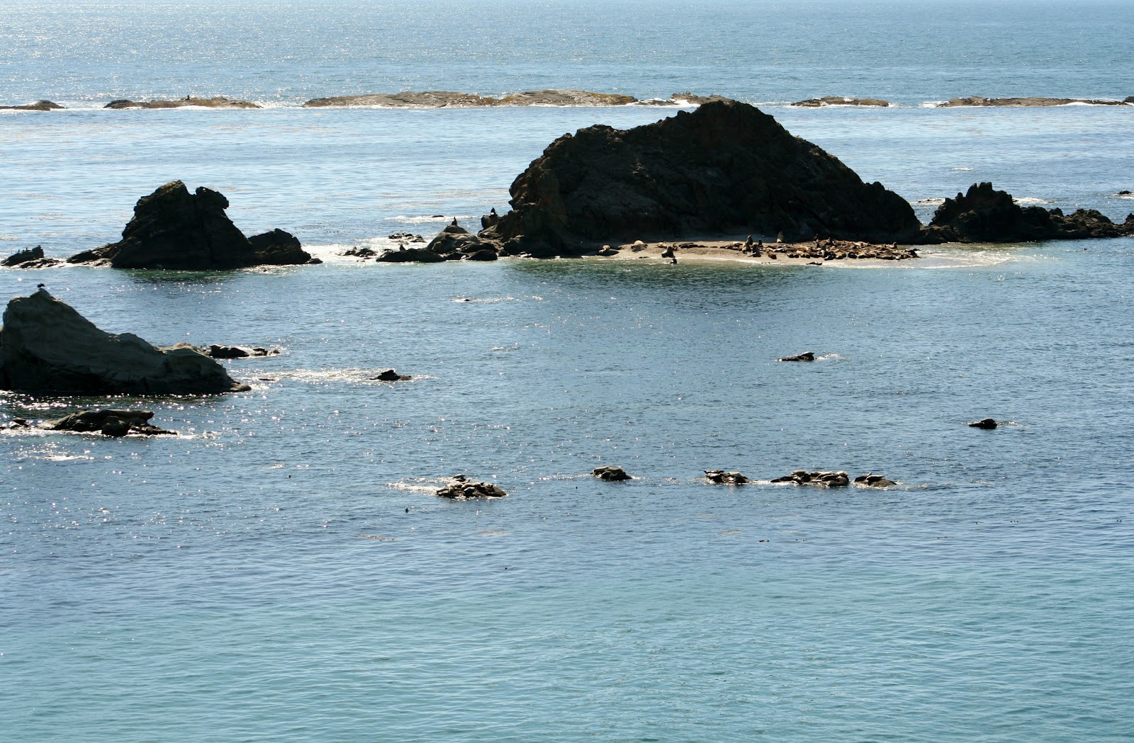 |
| Bring your binoculars and zoom lens, because they are too small to see otherwise. |
 |
| I wish I had a better zoom than the one I have, because this barely does the trick. |
 |
| If there was a rock available, there was a seal or sea lion on it. |
 |
| The sea lions all had their heads toward the sun. |
 |
| Further south we came to another park area. If there was a sign giving the name of the park, I missed it.It had a nice path down to the sea edge. |
 |
| View at the end of the path looking north. |
 |
| Looking out at the same rocks that we saw from Simpson Reef. |
 |
| I could get a better view of the seals and sea lions from this point with my zoom lens. |
 |
| I am not sure if they were closer, or if the lighting was better from that point. |
 |
| Another view of the coastline as I walked back up the trail to the car. |
 |
| The road ends at this point and circles around heading back north up Cape Arago Hwy. |
 |
| We missed this viewing point of Cape Arago Lighthouse, when we were driving south, but when we headed back we notice a couple of cars there, and stopped. The pull out is a small gravel spot, so it is easily missed! |
 |
| This is the closest you can get to Cape Arago Lighthouse. This lighthouse was first lit in 1934, but there were previous lighthouses built in 1866 and then in 1908. Both earlier lighthouses succumbed to weather and erosion. |
 |
| The lighthouse stands 100 feet above the ocean. |
 |
| This lighthouse is owned by area tribes. |
 |
| On the way home we stopped at the South Slough National Estuarine Reserve. |
 |
| The Estuarine has slide shows on birds and animals and a gift shop. |
 |
| It was closed as it was past 5:00 when we arrived. The visitor Center is open from 10:00 to 4:30. |
 |
| There is a ten minute trail you can take if you have time. |
 |
| 7 Devil Road joins back into Beaver Hill Road, which takes you back to Hwy. 101. While on 7 Devil Road, you are up pretty high and get some nice views. |
No comments:
Post a Comment