We have had many traveling RVer"s tell us we must see Joshua Tree National Park. We had never heard of it, but put it on our things to see list.
 We left Desert Hot Springs in the Honda and headed north east on Twentynine Palms Highway.
  The desert is coming alive with yellow flowers.
  After about a 30 mile drive we reach the visitor center. After getting information about the park we continue our day drive into the park. We got in free because we bought an annual National Park Pass last fall.
  This is a Joshua Tree. We had never heard of or seen one before.
  The park is filled with Joshua Trees and piles of boulders.
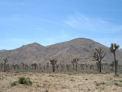
  Forest of Joshua Trees.
  The Joshua tree is found in the high desert called the Mohave Desert.
  The Joshua tree, Yucca brevifolia, is a giant member of the lily family. Legend has it that a Mormon immigrants named the tree after the biblical figure, Joshua, seeing the limbs of the tree outstretched in supplication, guiding the travelers westward.
  Many places for rock climbers.
  More piles of boulders. It looks like some giant came along and balanced rocks together in a pile.
  Lots of amateur boulder climbers to the top.
  And then the Hemingway Buttress & Banana Cracks for the professional climbers.
  Do you see the two cracks? Do you see the rock climbers?
  A close up of the climbing access. Can you see the climbers in the cracks.
  An even closer shot. Can you see the climber?
  We then drove to Keys View in the park.
  Keys View is 5185 feet high.
  San Gorgonio Mountain 11,485 feet, is the tallest point in Southern California. ( the snow peak mountain in the distance)
  Mount San Jacinto at 10,831 feet is more than twice the height of the mountains within Joshua Tree National Park. ( the snow peaked mountain in the distance)
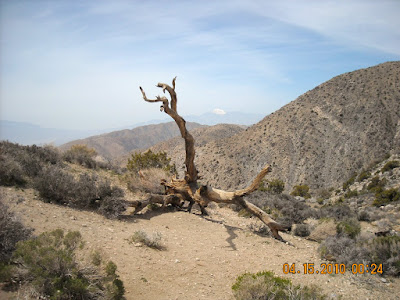
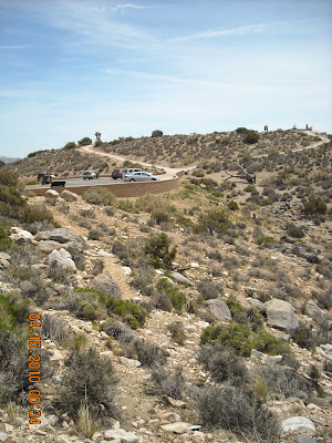
  A view from the top of the trail to the parking lot.
  A view of the Coachella Valley below with Palm Springs to the right in the valley.
  On a clear day you can see the Salton Sea which is 234 feet below sea level, some 35 miles away. The Mexican border can also be seen on clear days.
  The views in the summer months are the most hazy, and the winter months the clearest.
  Bloom on a Joshua Tree.
  A close up of the bloom.
  A Joshua Tree is made of fibers like palm trees, so they can bend. They are not made of wood like other trees.
  I spotted a flowering cactus on the slope of a mountains.
 You know me and flowers.
  My view down where I found the cactus.
  Joe is over there on top of the look out view sitting on a bench eating his sack lunch while I am exploring.
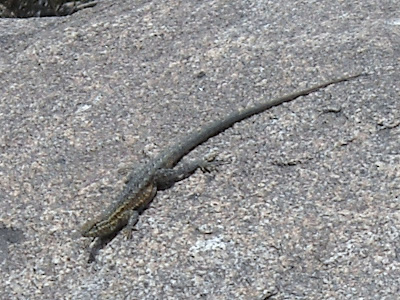
  Oh look there is a little lizard on the boulder!
  Hi little Lizard.
  One last look as I best be getting back to Joe.
  Heading back up the road as Keys View is a twenty minute one way dead end, but worth the 20 miles.
  Another blooming Joshua Tree. Most of them have already bloomed, so I feel lucky to see some still blooming.

 Cap Rock ahead.
  We stopped here and walked on a short .4 mile loop and then we sat at a picnic table while I ate my sack lunch.
 I had found another blooming cactus at Cap Rock.
 After a short drive we parked at Jumbo Rocks Campground to hike a 1.7 mile hike.
  It was a very nice day in the low 70's.
  I found some green and blue lichen on a boulder.
  That boulder ahead looks like a side view of a guy with a big gut and big lower lip.
  There is Skull Rock!
  Do you see the face in the middle rock?
  It was a nice and easy hike with just a few inclines at the end of the trail.
  At the end of the trail on a few of the inclines, my mind kept thinking of mountain lions. I don't even know if they have mountain lions in this area?
  Some pretty light purple wild flowers.
 Then we drove to White Tank Campground and walked the .3 mile loop to see Arch Rock. After this rock we saw a bigger lizard, but my batteries in my camera were almost dead, and I could not get the picture. We also stopped at the Cholla Cactus Garden, which I would have loved to have taken a picture of, but I forgot to keep spare batteries on hand. We continued our loop drive heading south to Cottonwood Visitor Center in the Joshua State National Park.
  This National Park is hugh and as we traveled south the landscape and mountains makeup changes a lot. I got one last photo shot (when my batteries die, after it rest for a while I can some times get one or two pictures before they are completely dead). As we got farther south there were masses of fields of yellow flowers in bloom for as far as you could see. It was such a pretty picture with the setting sun. I was so bummed I didn't have any spare batteries. The whole day drive loop was 150 miles as we hooked into Hwy 10 south of Joshua Tree Park and headed west to Desert Hot Springs. There is so much more to see, but just not enough day light or energy.


That was a fun day spent wandering around in the desert with you..I really liked the cool rock formations..and I saw that fat bellied guy with the big lower lip..heee hee..
ReplyDeletegood to see this.... welcome to india
Delete