


 |
| Our new neighborhood was close to Bath, ME., so we decided to visited the town. We split up again, because Joe was not interested in going into the shops. |
 |
| Joe took this picture, while I spent most of my time in one shop. The shop was filled with local artist wears. There was so much neat stuff to look at in the store. |
 |
| Joe went down by the river and viewed the shipyards. Bath is renowned for shipbuilding, which began here in 1743 when Jonathan Philbrook and his sons built 2 vessels.Since then, roughly 5,000 vessels have been launched in the area, which at one time had more than 200 shipbuilding firms. Bath became the nation's fifth largest seaport by the mid-19th century, producing clipper ships that sailed to ports around the world.[4] The last commercial enterprise to build wooden ships in the city was the Percy & Small Shipyard, which was acquired for preservation in 1971 by the Maine Maritime Museum. But the most famous shipyard is the Bath Iron Works, founded in 1884 by Thomas W. Hyde. It has built hundreds of wooden and steel vessels, mostly warships for the U.S. Navy.[3] During World War II, Bath Iron Works launched a new ship every 17 days. The shipyard is a major regional employer, and operates today as a division of the General Dynamics Corporation. Since 9/11 the only way you can see the shipyard up close is to take a guided tour that costs $14 per person. |
 |
| After I shopped a bit, I met up with Joe again. How did we live without cell phones. We then walked around the historic area to look at the 19th century architecture. |
 |
| We had a self guided walking and driving tour of architecture of Bath in hand. The tour starts at the Chocolate Church: Gothic Revival. We thought this was the church. (This is the Winter ST. Center instead, from later research). The information on the guide did not seem to match up with the homes. We gave up and drove the tour and just looked at the homes on the streets. |
 |
| The walking tour started on Washington Street. Across the street was a park with the Spirit of the Sea statue in a pond. |

 |
| This may be a Greek Revival Style, from looking at the architecture pamphlet.. |
 |
| I think this is a Second Empire/Mansard Style 1860's- 1900's |
 |
| This looks like a Italianate Style 1850's -1860's |
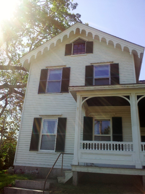 |
| Gothic Revival Style 1835-1870's |
 |
| Joe liked this huge boat by it's very small home. |
 |
| The next three pictures are of the same home. |
 |
| This home looks like it might be a Greek Revival from the brochure pictures, but don't know since we couldn't seem to follow the tour from our wrong starting point. |
 |
| All I can say is it is pretty massive. |
 |
| Af\ter our driving tour of the architecture, we drove down to the river park for lunch. The bridge ahead is Hwy. 1 bridge. |
 |
| We found a bench in the shade along the Kennebec River. |
 |
| Along the park there is a city docks to tie off your boat, to come to town. |
 |
| Everything seemed new in the park, from benches to restrooms. |

 |
| After lunch we drove down Hwy 209 on a Bath peninsula to Hermit Island. |
 |
| On the Island was a beach. We had Mallery with us and dogs are not allowed on the beach. There is also a fee to go on the beach. We followed another lady up the sand hill with her dog. |
 |
| At the top of the hill I looked to the left, |
 |
| and to the right. This is the first real sand beach we have seen since we left the Outer Banks in North Carolina. |
 |
| Joe stayed back with Mallery, as I walked out to the water. Lots of seaweed or kelp on the beach. |
 |
| I found a couple of shells and headed back to Joe and Mallery. Time to leave, before we get in trouble with a dog and not paying. |
 |
| On the far end of the island was a camping park. Joe went to check out information on the camping park. While he was gone, Mallery and I walked around. I could see a person way out in the mud flats of low tide. |
 |
| He was digging I suppose for clams, mussels, or steamers. |
 |
| There were also some sunflowers at the park entrance sign. Joe found out that the camping park is only for tents and pop ups, no bigger RVs |
 |
| During our exploring of the peninsula, we found a fort at the end of another point. |
 |
| There was no charge or fee to enter. |
 |
| From signs we found out this was Fort Popham. |
 |
| Fort Popham is a coastal defense land battery at the mouth of the Kennebec River in Phippsburg, Maine |
 |
| It is located in sight of the short-lived Popham Colony and, like the colony, named for George Popham, the colony's leader. |
 |
| During the American Revolution a minor fortification stood on this site; in 1808 the federal government built a small battery derisively known as an "embargo fort" on this location as part of the second system of fortifications that guarded the coast. It remained manned until 1815 and saw minor action during the War of 1812. |
 |
| Construction of Fort Popham was authorized in 1857 but did not begin until 1861. The fort was built from granite blocks quarried on nearby Fox and Dix islands. It had a 30-foot (9 m)-high wall facing the mouth of the Kennebec River and was built in a crescent shape, measuring approximately 500 feet (150 m) in circumference. |
 |
| Fort Popham's armament consisted of 36 cannons arranged in two tiers of vaulted casements. The back side of Fort Popham was built with a low moated curtain containing a central gate and 20 musket ports. |
 |
| In 1869 construction at Fort Popham stopped before the fortification was completed. The fort was garrisoned again after additional work was performed during the Spanish-American Warand World War I. Construction of Fort Baldwin on the headland above Fort Popham began in 1905 with longer-range guns, which eventually rendered Fort Popham obsolete. |
 |
| We left the fort and found a hill over looking it, as well as the river and surround area. This is a beach just down from the fort. |
 |
| Out from the beach is a lighthouse. I think this is Pond Island Lighthouse from my research. |

 |
| Close up of the beach. |
 |
| Closer still. |
 |
| View of the fort from the hill. |
 |
| View of Atkins Bay. |
 |
| Close up of an iconic New England church in the Atkins Bay. |
 |
| As we left the point, we drove by the church, and I got a picture of the church from across the street. |
 |
| Our next stop was at Popham State Park Beach. It was getting late, so we asked the gate keeper if we could just drive in to see the beach for just a minute or two and not have to pay the $6 per person entry fee. |
 |
| We have found that most rangers will let you drive in for 10 minutes, and not pay, which she did on that day. The beach is out past the river that has changed it's path in front of the beach. |
 |
| If you go farther to the left, you can walk straight out to the ocean, and miss the river. We came back to this beach on another day and will blog more about it in the future. |
No comments:
Post a Comment