RVery Best Nest

Come join Joe, Mallery & I, as we travel around the USA in our RVery Best Nest. God's Favor has been chasing us down, and we are enjoying all of His blessing's, that He has created for all to enjoy!


Monday, September 5, 2011

Day Drive to Explore Second Half of Penobscot & Blue Hill Peninsula

We left Patten Pond and drove south on Hwy.1 and turned southeast at Hwy.15. At Hwy 199 we went SW to the town of Penobscot. Penobscot is a cute small town, and if you have time you could stop at a few shops. We drove through onto Hwy 175/176  then back to 15 to Brooksville. Outside of Brooksville, at the top of a hill there is a scenic overlook. We missed it and had to turn around. It is worth the stop. You are looking out across a small bay, then out to Eggemoggin Reach and or the Penobscot Bay.

A close up of previous picture.

Another close up.

The views were so much better in real life. This is the best our camera's can do. There were some homes that sat on hills above where we were. We drove up to see their views. They were fantastic, but we did not stop for a picture because there was no where to park.

Then we drove over the bridge to Deer Isle.


Across the bridge a bit further was the visitor center. I liked their pretty painted trash can. There were out houses if you need to use a restroom. That's one thing I do not like about Maine. It is hard to find public restrooms.

After getting some tips for scenic drives, we head on Hwy. 15 through Deer Isle Village. Another place to stop for lunch or shopping if you have time. Right outside of  Deer Isle Village, we took a right onto Pressey Village Rd. Tide was out as we drove past this bay.

With map in hand from the visitor center , we struggled to find Dunham Pt. Rd., while passing another bay.


We connected back to 15A  to Goose Cove Road.

At the end of Goose Cove Road, we found a place to park to eat our lunch.

After lunch we should have walked the beach, but we needed to continue our exploration of the island.


We drove down one road and came to a resort area. There were several cabins and a restaurant  in the registration building.

The resorts view. I forgot to get the name of  the resort.


15A took us past another bay.


On one side of the bay we drove to the point, which ended with a lobster pound dock.

After leaving this bay we took Sand Beach Rd off of 15A.

We would have drove right past this beach, because it is not visible from the road. The visitor's center had told us to watch for a bend in the road where there would be a lot of cars parked along the edge of the road. No parking lot.


We knew we had arrived by the cars lined along the road. We parked and walked up a path to this sand beach.

The water was really cold and it was in the low 70's. The nights in Maine are very cool, so the water doesn't warm up as much as in the south. There were still kids swimming in the water. I had carried Mallery to the beach, in her front pack, but when we got to the beach we found out, dogs are allowed on the beach on a leash.

Way out from the beach on a island was a lighthouse. We have seen many light houses in Maine, they all seem so short compared to the tall light houses we visited on the Outer Banks. Maybe it's because they are so far away.

These next two pictures are just up from Sand Beach next to a home.


We then hook back into Hwy. 15

This is  Stonington Village.


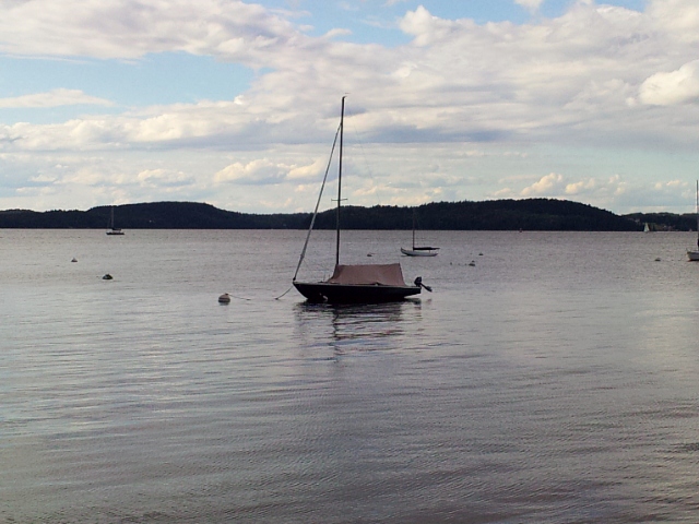
As you can see, it is a very photogenic village. We really love the simple fishing and lobster boats you find in almost every harbor. No big docks, just a lot of buoy's and small row boats tied together to get you out to your buoy.


A close up of a schooner that you can take day and sunset cruises on. It almost looks out of place except for its old style tall masts.

We parked and walked around the village of Stonington.

Up on the hill we came to the Ocean View House.

It is a private home with an antique business in the back end of the house.


Replicate buoy's for sale.


Each lobster fishermen has a different color and design of his buoys, so they can distinguished theirs between all the other buoy's at sea.

As Joe was shopping at the antique shop, Mallery and I walked up the street to the end, to view the harbor from the opposite direction.

After Joe got done looking around the antique shop, Joe thought more of the village was further up another hill. We climbed up it.

At the top, we found it was just a dead end housing district. I think Joe just though I needed some exercise. The homes on this hill had great views also.

I zoomed in with my camera between the homes to another schooner sitting in the bay.

We left Stonington Village and got back on Hwy. 15. We really like the definition that the little islands give to the bays.


We got back on track and followed the east coast of  Deer Isle back to our starting point. We drove past the Visitors Center on Eggemoggin Rd to the point. The man at the visitor center had told us that at this point we could see another lighthouse.

Joe zoomed in from the last picture. He is using my old point and shoot camera, and I am using my smart phone. The point and shoot gets better zoom in pictures than my phone. I need to take the time to learn more about my phone's capabilities.

Most of all the lighthouses are on islands, so it is hard to get good pictures of them.

It was cloudy and getting close to Joe's 5:00 curfew, and we had to travel all the way back up the Penobscot/Blue Hill Peninsula.

A look to the left from the Eggemoggin Rd. Point.

A look to the right from the Eggemoggin Rd. Point.

At the left was a road that had this sign. I guess they get tired of  pokers. ( A word I learned from a tourist from West Virginia in the Outer Banks, in North Carolina. He said he and his wife were just poking around. I had never heard that word in those terms).

We crossed back over the bridge to get to the peninsula, and head home.

We took a different route to see different views. We took Hwy 175 through South Brooksville.

Joe was burnt out by now because it was after five, so I was driving home. When I drive, I get to stop where I want to stop, instead of seeing things whizzing by.

I stopped along the roadside on Hwy 176.  This home to the right had gorgeous views.

Close up from previous picture. We did not have time to see Harborside  and Cape Rosier. There was also a small western section of the peninsula we missed with the town of Castina.

We have noticed when the tide is coming into bays, the current is really strong. You really see it, when you cross the small bridges. I stopped to get this shot of the tide current coming in.
We just arrived in Moody, ME. yesterday for a two week stay. This will be the longest stay since we left the girls in Gulf Shores, AL. the first of March.. I love traveling, but the constant moving can get wear on you. Our stay here is a much needed stop and it is free. This is where Joe is enjoying the investment of  the Thousand Trail Membership, we bought this spring for the NE region. Joe figured each stay was worth about $25 per day (which is what he figured we would have spent without the membership which cost $500.)  Up to now we have used it for 25 days worth of camping; with our 14 day stay here in Moody, Me. we will be up to 39 days. That puts us at $12.82/day for the last 39 days stay in Thousand trails parks, or a savings of $475 0ff the $500 membership rate.)


1 comment:

  1. Beautiful area! Glad you are settling down for a bit..:) Good think you saw NH and Vt when you did..they were hit hard. Queeche lost alot of homes and covered bridge almost down. The Kankamagus highway is closed..Bridge out to Loon mountain and lots more damage. Yikes

    ReplyDelete